Search Results
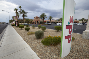
Traffic on East Sahara Avenue looking west at dusk, Las Vegas, Nevada: digital photograph
Date
2017-09-12
Archival Collection
Description
Traffic flows along East Sahara Avenue near South Bruce Street.
Image
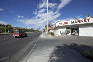
Value Market on East Sahara Avenue looking west, Las Vegas, Nevada: digital photograph
Date
2017-09-13
Archival Collection
Description
Traffic flows past the Value Market on East Sahara Avenue near Chapman Drive.
Image
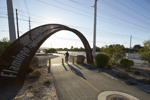
Bicyclist on Flamingo Arroyo path, looking east, Las Vegas, Nevada: digital photograph
Date
2017-09-28
Archival Collection
Description
A bicyclist makes his way up a path that parallels the Las Vegas Wash off Sloan Lane south of East Sahara Avenue. The path is part of the Flamingo Arroyo Trails system and is connected to the Sloan Trailhead.
Image
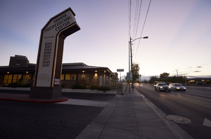
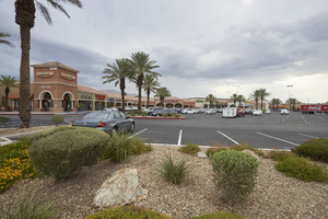
Winterwood Pavilion on Nellis Bouleavard and East Sahara Avenue, Clark County, Nevada: digital photograph
Date
2017-09-08
Archival Collection
Description
The Winterwood Pavilion sits on the northeast corner of East Sahara Avenue and Nellis Boulevard.
Image
Winterwood Pavilion on Nellis Bouleavard and East Sahara Avenue, Clark County, Nevada: digital photograph
Date
2017-09-08
Archival Collection
Description
The Winterwood Pavilion sits on the northeast corner of East Sahara Avenue and Nellis Boulevard.
Image
Gold Coast: 2 FL east casino Coast Resorts correspondence, 2002
Level of Description
File
Archival Collection
J. A. Tiberti Construction Records
To request this item in person:
Collection Number: MS-00855
Collection Name: J. A. Tiberti Construction Records
Box/Folder: Box 205
Collection Name: J. A. Tiberti Construction Records
Box/Folder: Box 205
Archival Component
Gold Coast: 2 FL east casino Leo A Daly correspondence, 2002
Level of Description
File
Archival Collection
J. A. Tiberti Construction Records
To request this item in person:
Collection Number: MS-00855
Collection Name: J. A. Tiberti Construction Records
Box/Folder: Box 205
Collection Name: J. A. Tiberti Construction Records
Box/Folder: Box 205
Archival Component
Endowment for the Middle East Truth (EMET) Speaker of the Truth Award, 2008
Level of Description
Item
Archival Collection
Shelley Berkley Papers
To request this item in person:
Collection Number: MS-00599
Collection Name: Shelley Berkley Papers
Box/Folder: Box 42
Collection Name: Shelley Berkley Papers
Box/Folder: Box 42
Archival Component
Section of desert range, east-west, near south end, 1926
Level of Description
File
Archival Collection
Chester R. Longwell Professional Papers
To request this item in person:
Collection Number: MS-00017
Collection Name: Chester R. Longwell Professional Papers
Box/Folder: Box 02
Collection Name: Chester R. Longwell Professional Papers
Box/Folder: Box 02
Archival Component
Interstate Company, Souvenir playing cards for Florida East Coast, undated
Level of Description
Item
Archival Collection
Harrah’s Entertainment Corporate Archives
To request this item in person:
Collection Number: MS-00460
Collection Name: Harrah’s Entertainment Corporate Archives
Box/Folder: Box 103 (Restrictions apply)
Collection Name: Harrah’s Entertainment Corporate Archives
Box/Folder: Box 103 (Restrictions apply)
Archival Component