Search Results
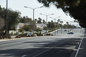
Looking east up Windmill Lane east of Eastern Avenue, in Henderson, Nevada: digital photograph
Date
2019-03-26
Archival Collection
Description
From the UNLV University Libraries Photographs of the Development of the Las Vegas Valley, Nevada (PH-00394). Part of the collection documents the entire 19 mile length of the north/south Eastern Avenue / Civic Center Drive alignment. This photograph was captured in the section of Eastern Avenue between Windmill Parkway and Pebble Road.
Image
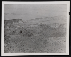
East view of the Black Canyon: photographic print
Date
1930 (year approximate) to 1933 (year approximate)
Archival Collection
Description
An east view of the Black Canyon area looking from the Arizona side of the Colorado River. Fortification Hill is on the left side of the photograph.
Image
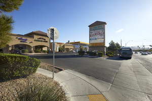
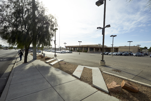
Sun West Marketplace on East Sahara Avenue west of Sloan Lane, looking east, Las Vegas, Nevada: digital photograph
Date
2017-09-28
Archival Collection
Description
An RTC bus stops in front of the Sun West Marketplace on East Sahara Avenue west of Sloan Lane.
Image
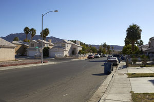
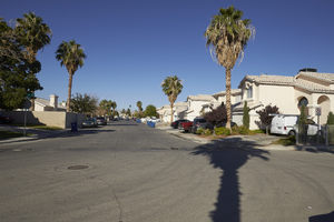
Woodfield Drive off Sloan Lane north of East Sahara Avenue, looking east, Las Vegas, Nevada: digital photograph
Date
2017-09-28
Archival Collection
Description
Single family homes along Woodfield Drive off Sloan Lane north of East Sahara Avenue.
Image
Closed car lot on West Sahara Avenue east of Decatur Boulevard, looking east, Las Vegas, Nevada: digital photograph
Date
2017-09-19
Archival Collection
Description
A former car sales lot is used as a storage facility on West Sahara Avenue east of Decatur Boulevard.
Image
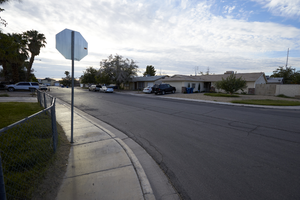
Single family housing northwest of East Sahara Avenue and Lamb Boulevard, looking east, Las Vegas, Nevada: digital photograph
Date
2017-09-26
Archival Collection
Description
A typical single family housing development on Miner Way northwest of East Sahara Avenue and Lamb Boulevard.
Image
Bus stop on East Sahara Avenue and 15th Street looking east at dusk, Las Vegas, Nevada: digital photograph
Date
2017-09-12
Archival Collection
Description
An RTC Sahara Express bus stop on East Sahara Avenue near the crosswalk to 15th Street.
Image
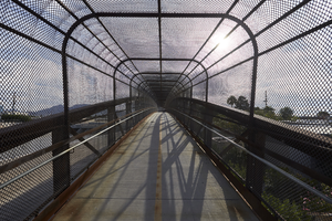
Interior of Bridge crossing Lamb Boulevard south of East Sahara Avenue, looking east, Las Vegas, Nevada: digital photograph
Date
2017-09-26
Archival Collection
Description
Inside of a bridge that is part of the Flamingo Arroyo Trail system as it crosses Lamb Boulevard south of East Sahara Avenue.
Image
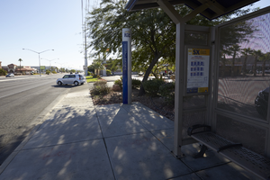
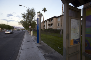
Bus stop on West Sahara Avenue east of Torrey Pines Drive, looking east, Las Vegas, Nevada: digital photograph
Date
2017-09-20
Archival Collection
Description
An RTC Sahara Express bus stop sits along West Sahara Avenue east of Torrey Pines Drive.
Image
Single family homes off East Sahara Avenue east of Sloan Lane, looking west, Las Vegas, Nevada: digital photograph
Date
2017-09-28
Archival Collection
Description
Singe family homes line Pacific Shores Drive as seen from Pacific Summit Street off East Sahara Avenue east of Sloan Lane.
Image