Search Results
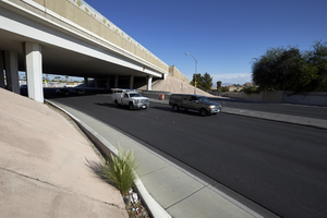
Traffic flows under the freeway overpass at East Sahara Avenue and Sandhill Road looking west, Las Vegas, Nevada: digital photograph
Date
Archival Collection
Description
Image
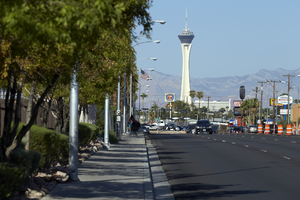
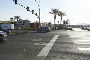
Stratosphere Tower as seen from East Sahara Avenue near Sandhill Raod looking west, Las Vegas, Nevada: digital photograph
Date
Archival Collection
Description
Image
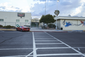
KO Knudson Middle School on Atlantic Street north of East Sahara Avenue looking west, Las Vegas, Nevada: digital photograph
Date
Archival Collection
Description
Image
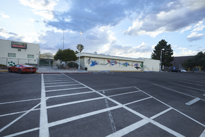
KO Knudson Middle School on Atlantic Street north of East Sahara Avenue looking west, Las Vegas, Nevada: digital photograph
Date
Archival Collection
Description
Image
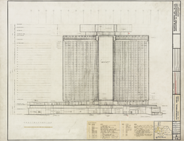
Architectural drawing of the International Hotel (Las Vegas), east elevation, north half, August 5, 1968
Date
Archival Collection
Description
Architectural plans for the International Hotel, Las Vegas, Nevada from 1968. Additional delineator identified with initials EPH. Printed on mylar. Berton Charles Severson, architect; Brian Walter Webb, architect; Jose Flor, delineator.
Site Name: International Hotel
Address: 3000 Paradise Road
Image
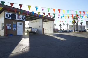
A car wash on Eastern Avenue, looking east-southeast in Las Vegas, Nevada: digital photograph
Date
Archival Collection
Description
From the UNLV University Libraries Photographs of the Development of the Las Vegas Valley, Nevada (PH-00394). Part of the collection documents the entire 19 mile length of the north/south Eastern Avenue / Civic Center Drive alignment. This photograph was captured in the section of Civic Center Drive and Eastern Avenue between Lake Mead Boulevard and Washington Avenue.
Image
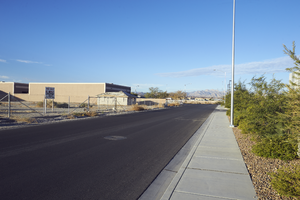
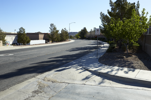
Looking west down East Branson Avenue in North Las Vegas, Nevada: digital photograph
Date
Archival Collection
Description
From the UNLV University Libraries Photographs of the Development of the Las Vegas Valley, Nevada (PH-00394). Part of the collection documents the entire 19 mile length of the north/south Eastern Avenue / Civic Center Drive alignment. This photograph was captured in the section of Civic Center Drive between Alexander Road and Cheyenne Avenue.
Image
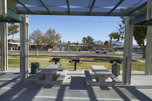
Looking east, picnic tables at Boris Park in North Las Vegas, Nevada: digital photograph
Date
Archival Collection
Description
From the UNLV University Libraries Photographs of the Development of the Las Vegas Valley, Nevada (PH-00394). Part of the collection documents the entire 19 mile length of the north/south Eastern Avenue / Civic Center Drive alignment. This photograph was captured in the section of Civic Center Drive between Cheyenne Avenue and Las Vegas Boulevard.
Image
The intersection of Eastern Avenue and Pebble Road, looking east in Las Vegas, Nevada: digital photograph
Date
Archival Collection
Description
From the UNLV University Libraries Photographs of the Development of the Las Vegas Valley, Nevada (PH-00394). Part of the collection documents the entire 19 mile length of the north/south Eastern Avenue / Civic Center Drive alignment. This photograph was captured in the section of Eastern Avenue between Windmill Parkway and Pebble Road.
Image
Reunion Drive near Eastern Avenue, looking east-northeast in Henderson, Nevada: digital photograph
Date
Archival Collection
Description
From the UNLV University Libraries Photographs of the Development of the Las Vegas Valley, Nevada (PH-00394). Part of the collection documents the entire 19 mile length of the north/south Eastern Avenue / Civic Center Drive alignment. This photograph was captured in the section of Eastern Avenue between Grand Hills and Sun City Anthem Drives.
Image