Search the Special Collections and Archives Portal
Search Results

Manhattan from across East River and Long Island City, New York: panoramic photograph
Date
1981-05-25
Archival Collection
Description
From the Bob Paluzzi Panoramic Photographs
Image
Poppy Lane at the Kit Kat Club, located at 2501 East Charleston Boulevard, Las Vegas, Nevada: digital image
Date
1943 to 1944
Archival Collection
Description
From the Dennis McBride Photograph Collection (PH-00263) -- LGBTQ+ events and organizations in Las Vegas, Nevada -- Digital images file. Notes from the donor, Dennis McBride: The address given for the Kit Kat Club is approximate as it stood on the outskirts of Las Vegas at what then was known as "Five Points": the intersection of East Charleston Boulevard, East Fremont Street, and the Boulder Highway [at this location today noted as the extension of East Fremont Street]. ... This photograph belongs to the Clark County Museum. ... For more on the Kit Kat Club, see Out of the Neon Closet: Queer Community in the Silver State, by Dennis McBride [North Charleston, South Carolina: CreateSpace Independent Publishing Platform], p. 56. Individuals identified by the donor, Dennis McBride: female impersonator Poppy Lane
Image
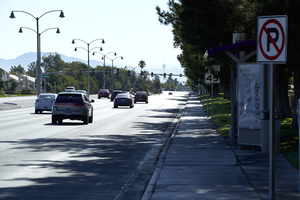
West Sahara Avenue looking east from South Hualapai Way, Las Vegas, Nevada: digital photograph
Date
2017-08-25
Archival Collection
Description
Looking east down West Sahara Avenue from South Hualapai Way. This view illustrates the difference between the lushly landscaped meandering sidewalks and medians of Summerlin and the less controlled areas of West Sahara Avenue's development. Straight roadside sidewalks, no median landscaping and a bus lane that begins at South Hualapai Way signal a transition from the popular masterplanned community.
Image
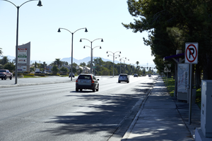
West Sahara Avenue looking east from South Hualapai Way, Las Vegas, Nevada: digital photograph
Date
2017-08-25
Archival Collection
Description
Looking east down West Sahara Avenue from South Hualapai Way. This view illustrates the difference between the lushly landscaped meandering sidewalks and medians of Summerlin and the less controlled areas of West Sahara Avenue's development. Straight roadside sidewalks, no median landscaping and a bus lane that begins at South Hualapai Way signal a transition from the popular masterplanned community.
Image
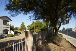
East Sahara Avenue west of Sloan Lane and Terrasanta Condominium development, looking west, Las Vegas, Nevada: digital photograph
Date
2017-09-28
Archival Collection
Description
Traffic uses East Sahara Avenue west of Sloan Lane next to the Terrasanta Condominium development.
Image
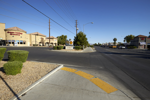
Commercial development on the northwest corner of East Sahara Avenue and Sloan Lane, looking north, Las Vegas, Nevada: digital photograph
Date
2017-09-28
Archival Collection
Description
A Green Valley Grocery store sits on the northwest corner of East Sahara Avenue and Sloan Lane.
Image
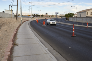
Car and trafic cones on East Sahara Avenue west of Lamb Boulevard, looking west, Las Vegas, Nevada: digital photograph
Date
2017-09-26
Archival Collection
Description
A car navigates through the traffic cones situated on East Sahara Avenue west of Lamb Boulevard.
Image
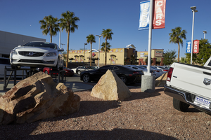
Used cars for sale on West Sahara Avenue east of Buffalo Drive, looking southwest, Las Vegas, Nevada: digital photograph
Date
2017-10-11
Archival Collection
Description
Used cars await customers at an auto dealership on West Sahara Avenue east of Buffalo Drive.
Image
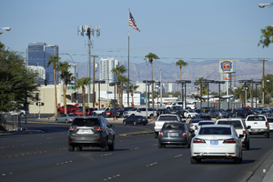
Traffic on East Sahara Avenue near Boulder Highway / Fremont Street looking west, Las Vegas, Nevada: digital photograph
Date
2017-09-14
Archival Collection
Description
Traffic flows along East Sahara Avenue as it curves towards Boulder Highway / Fremont Street.
Image
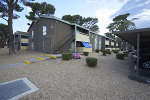
Apartments on Atlantic Avenue south of East Sahara Avenue near South Eastern Avenue, Las Vegas, Nevada: digital photograph
Date
2017-09-13
Archival Collection
Description
Apartments along Atlantic Avenue south of East Sahara Avenue near South Eastern Avenue.
Image
Pagination
Refine my results
Content Type
Creator or Contributor
Subject
Archival Collection
Digital Project
Resource Type
Year
Material Type
Place
Language
Records Classification
