Search the Special Collections and Archives Portal
Search Results
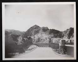
Photograph of Hoover Dam, circa late 1930s
Date
1935 to 1940
Archival Collection
Description
An image of Hoover Dam from the Arizona side. The name was officially changed from Boulder Dam to Hoover Dam in 1947.
Image
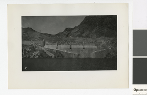
Photograph of Hoover Dam spillway, 1935-1940
Date
1935 to 1940
Archival Collection
Description
The spillway of the Hoover Dam. It was named Boulder Dam until 1947, when it was offically renamed the Hoover Dam. Site Name: Hoover Dam (dam)
Image
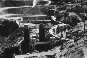
Slide of the Hoover Dam construction, circa 1930s
Date
1930 to 1939
Archival Collection
Description
Black and white image showing the construction of Hoover Dam. Note: Boulder Dam was officially renamed Hoover Dam in 1947.
Image
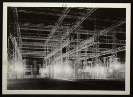
Photograph of Hoover Dam, circa 1935
Date
1935
Archival Collection
Description
Picture of the power substation construction at Hoover (Boulder) Dam.
Image
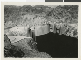
Photograph of the Hoover Dam, circa 1936
Date
1935 to 1937
Archival Collection
Description
An aerial, upstream view of the completed Hoover Dam.
Image
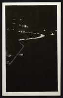
Photograph of Hoover Dam, circa mid 1930s
Date
1935 to 1936
Archival Collection
Description
An image of Hoover Dam's crest at night. Note: Boulder Dam was officially renamed Hoover Dam in 1947.
Image
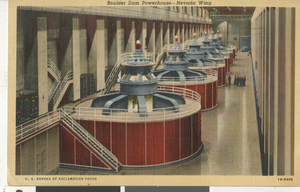
Postcard of Boulder Dam Powerhouse machines, Hoover Dam (Nev.), 1934-1935
Date
1934 to 1935
Archival Collection
Description
Boulder Dam Powerhouse, Nevada wing (postcard)
Image
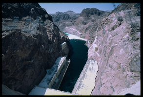
The front face of Hoover Dam looking down from atop Hoover Dam, Nevada: photographic slide
Date
1983-08
Archival Collection
Description
This series of photographs documents the historic water overflow at Hoover Dam as seen from the Arizona side of the dam. Taken in August of 1983, this overflow marked the first time the spillways were used during a flood. After initially being filled, the spillways were tested once in August of 1941.
Image

The front face of Hoover Dam looking down from atop Hoover Dam, Nevada: photographic slide
Date
1983-08
Archival Collection
Description
This series of photographs documents the historic water overflow at Hoover Dam as seen from the Arizona side of the dam. Taken in August of 1983, this overflow marked the first time the spillways were used during a flood. After initially being filled, the spillways were tested once in August of 1941.
Image
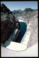
The front face of Hoover Dam looking down from atop Hoover Dam, Nevada: photographic slide
Date
1983-08
Archival Collection
Description
This series of photographs documents the historic water overflow at Hoover Dam as seen from the Arizona side of the dam. Taken in August of 1983, this overflow marked the first time the spillways were used during a flood. After initially being filled, the spillways were tested once in August of 1941.
Image
Pagination
Refine my results
Content Type
Creator or Contributor
Subject
Archival Collection
Digital Project
Resource Type
Year
Material Type
Place
Language
Records Classification
