Search the Special Collections and Archives Portal
Search Results

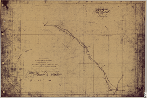
Map showing right of way of toll road constructed by Nevada Rapid Transit Co. in Lincoln County (Nev.), 1905
Date
1905
Description
Scale [ca. 126,720]. 1 in.=2 miles 1 map : blueline print ; 49 x 74 cmScale [ca. 126,720]. 1 in.=2 miles ; 1 map : blueline print ; 49 x 74 cm ; Shows right of way of what now is Interstate 95 through what is now Clark County, Nevada ; "Aug. 10, 1905." ; "Adopted as toll road of Nevada Rapid Transit Company at meeting of Board of Directors of said company Aug. 25, 1905. Attest Wh. Comstock, secretary, J. Ross Clark, president." ; "Book I, page 3"--Lower right corner of map ; "[Illegible] recording [illegible] J. Ross Clark September 1st. A.D. 1905 at 40 [illegible] 8 A in book of platts [illegible] Henry Lee [illegible]"--Upper right portion of map
Image
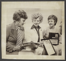
Photograph of the Betty Lee Lamping, Ruth Naylor, and Phyllis Crawley, Clark County, Nevada, May 13, 1976
Date
1976-05-13
Archival Collection
Description
Description provided with image: "Three Southern Nevada clubs won awards for outstanding civic projects at the biennial Nevada Federation of Women's Clubs. Representing the clubs are, L-R: Betty Lee Lamping, preside of the Junior Mesquite Club; Ruth Naylor, President of the Mesquite Club; Phyllis Crawley, President of the North Las Vegas Women's Club. (5-13-76)."
Image
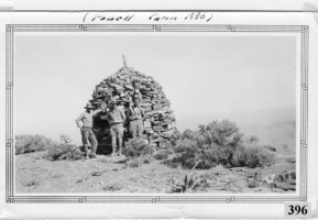
Photograph of Don Schuyler, Sr. on a survey crew with the U. S. Coast and Geodetic Survey at the Powell Cairn, Garfield County, Utah, circa 1935
Date
1933 to 1937
Archival Collection
Description
Donald Richard Schuyler, Sr. on a survey crew with the U.S. Coast and Geodetic Survey at the Powell Cairn, circa 1935. Powell Cairn was built about 1880 by John Wesley Powell on his exploration of the southwestern United States. The Powell Survey Cairn is located in Garfield County, Utah, at N37.93193° W112.20548° (NAD83) and at an elevation of 10216 ft MSL. The primary coordinates for Powell Survey Cairn places it within the ZIP Code 84712 delivery area. It can be seen on the USGS 1:24K topographic map Adams Head, UT.
Image
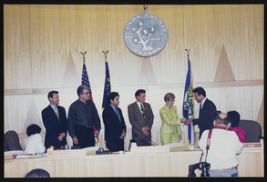
Meeting in Clark County government building, Culinary Union, Las Vegas (Nev.), 1990s (folder 1 of 1), image 10
Date
1990 to 1999
Description
Arrangement note: Series II. Public Events
Image
Pagination
Refine my results
Content Type
Creator or Contributor
Subject
Archival Collection
Digital Project
Resource Type
Year
Material Type
Place
Language
Records Classification
