Search the Special Collections and Archives Portal
Search Results
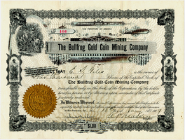
Certificate, The Bullfrog Gold Coin Mining Company, January 13, 1909
Date
1909-01-13
Archival Collection
Description
Certificate, The Bullfrog Gold Coin Mining Company, January 13, 1909
Image
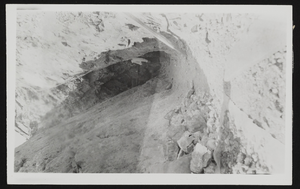
Entrance to the "Denver Vein," Bullfrog Mine: photographic print
Date
1905
Archival Collection
Description
The prospect entrance of the "Denver vein" within the Bullfrog Mine in Rhyolite, Nevada.
Image
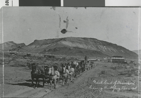
Photograph of a carriage leaving the tent camp in Bullfrog (Nev.), 1905
Date
1905-12-01
Archival Collection
Description
Freight team leaving Bullfrog, Nevada, December 1, 1905. There is an inscription on the back of the photo: "Headed for Goldfield, 65 miles to the north. Bullfrog was founded after the discovery of gold in the area in 1904. By 1907 Rhyolite, the tent camp at the left in the picture, had become the city of the district with a population of over 6000. The boom was over by the end of 1907." There is a date stamp: 1980.
Image
Menu: The Montgomery Cafe, Bullfrog, Nevada, 1904
Level of Description
File
Archival Collection
C. A. Earle Rinker Papers
Pagination
- Previous page ‹‹
- Page 12
Archival Component
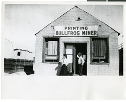
Photograph of the Bullfrog Miner Print Shop, Las Vegas, circa 1930s
Date
1930 to 1939
Archival Collection
Description
Two people stand out front of the Bullfrog Miner Print Shop.
Image
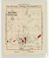
Map of the Bullfrog Mining District, Nye County, Nevada, circa 1905
Date
1901 to 1909
Description
At top of map: 'Compliments of the Forward Mining Development Co.' On left and right margins: 'The Patrick Investment Company, Fiscal Agents.' At bottom of map: '19 Toltec Block, Denver, Colorado.' 'The Williamson-Haffner Co., Denver.' Relief shown by hachures. Properties owned by Patrick Investment Company are marked in red. Shows railroads, roads, and pipelines. Scale [ca. 1:39,000. 1 in. to approx. 3,250 feet].
Image
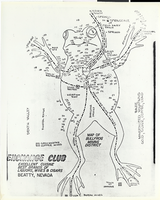
Photograph of the famous map of Bullfrog Mining District, Beatty, Nevada, circa 1950s
Date
1950 to 1959
Archival Collection
Description
The famous map of Bullfrog Mining District, designed by T.G. Nicklin, editor Of the Bullfrog Miner, Beatty, Nevada, shortly after the founding of the town of Beatty. This particular copy was distributed by the Exchange Club, probably During the 1950s. The town of Beatty is featured at the Bullfrog's heart. (Courtesy of Claudia Reidhead, Beatty, Nevada.) The Bullfrog Miner was published betweeen April 8, 1905-July 1909.
Image
Aerial photograph of houseboats moored in Bullfrog Bay near Bullfrog Marina on Lake Powell in Utah: digital photograph, 2022 April 30
Level of Description
File
Archival Collection
Jamey Stillings Photographs
Pagination
- Previous page ‹‹
- Page 12
Archival Component
Aerial photograph of houseboats moored in Bullfrog Bay near Bullfrog Marina on Lake Powell in Utah: digital photograph, 2022 April 30
Level of Description
File
Archival Collection
Jamey Stillings Photographs
Pagination
- Previous page ‹‹
- Page 12
Archival Component
Pagination
Refine my results
Content Type
Creator or Contributor
Subject
Archival Collection
Digital Project
Resource Type
Year
Material Type
Place
Language
Records Classification

