Search the Special Collections and Archives Portal

Search Results

Display    Results Per Page
Displaying results 1261 - 1270 of 3799

Jamey Stillings Photograph Collection

Identifier

PH-00380

Abstract

The Jamey Stillings Photograph Collection (2009-2019) is primarily comprised of photographs taken by professional photographer, Jamey Stillings, of the Mike O’Callaghan-Pat Tillman Memorial Bridge and the Hoover Dam project, the Ivanpah Solar Electric Generating System project, and the Crescent Dunes Solar project. The Mike O’Callaghan-Pat Tillman Memorial Bridge and the Hoover Dam project depict the construction of the Mike O’Callaghan-Pat Tillman Memorial Bridge from 2009 to 2012. The Ivanpah Solar Electric Generating System project depict aerial views of Ivanpah Solar in the Mojave Desert of California from 2010 to 2014. The Crescent Dunes Solar project consists of a range of aerial and ground-based work documenting SolarReserve's Crescent Dunes Solar, a 110MW concentrated solar plant with molten salt storage near Tonopah, Nevada, from 2014 to 2015.

Archival Collection

Fred and Maurine Wilson photographs (unidentified), image 14

Date

1860 to 1869

Description

Unidentified person diving off of a bridge in a swimsuit. Others watch along the bridge. At the top, "I DIVE" is handwritten.

Image

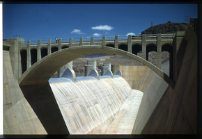
Slide of the spillways at Hoover Dam, circa late 1930s

Date

1936 to 1940

Archival Collection

Description

The spillway bridge at Hoover Dam.

Image

Film transparency of Grand Canyon, circa 1929-1930

Date

1929 to 1930

Archival Collection

Description

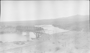
Photograph of an unidentified bridge over the Grand Canyon.

Image

Film transparency of Lorenzi Park, Las Vegas, 1931-1932

Date

1931 to 1932

Description

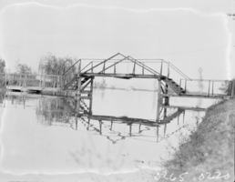
A bridge across the pond at Lorenzi Park in Las Vegas, Nevada.

Image

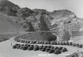
Hoover Dam album, image 023

Date

1931 to 1936

Description

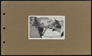
Arizona spillway and bridge, Boulder Dam, 1931-1936

Image

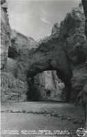
Postcard showing a rock formation in Death Valley, California, circa 1930s to 1950s

Date

1930 to 1955

Archival Collection

Description

A view of Natural Bridge Canyon and its rock formations with the description, "Natural Bridge, Death Valley National Monument, California."

Image

Photograph of the Arizona spillway, Hoover Dam, circa 1935

Date

1935

Archival Collection

Description

Picture of the Arizona spillway and bridge.

Image

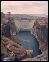
Film transparency of the south face Glen Canyon Dam, Arizona, circa 1966-1970s

Date

1966 to 1979

Description

Glen Canyon Dam is a concrete arch dam on the Colorado River in northern Arizona in the United States, near the town of Page. Its reservoir is called Lake Powell, and is the second-largest artificial lake in the country, extending upriver well into Utah. The dam is named for Glen Canyon, a colorful series of gorges, most of which now lies under the reservoir. The dam was proposed in the 1950s as part of the Colorado River Storage Project, a U.S. Bureau of Reclamation (USBR) federal water project that would develop reservoir storage on the upper Colorado River and several of its major tributaries. Construction of Glen Canyon Dam started in 1956 and was not finished until 1966. The Glen Canyon Bridge or Glen Canyon Dam Bridge is a steel arch bridge in Coconino County, Arizona, carrying U.S. Route 89 across the Colorado River. The bridge was originally built by the United States Bureau of Reclamation to facilitate transportation of materials for the Glen Canyon Dam, which lies adjacent to the bridge just 865 feet (264 m) upstream. Carrying two lanes, the bridge rises over 700 feet (210 m) above the river and was the highest arch bridge in the world at the time of its completion in 1959.

Image

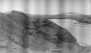
Film transparency of the Grand Canyon, circa 1929-1930

Date

1929 to 1930

Archival Collection

Description

Photograph of the Navajo Bridge at the Grand Canyon. It is used to cross the Colorado River's Marble Canyon.

Image