Search the Special Collections and Archives Portal
Search Results
Negative of Chic'n Box sign, Las Vegas, Nevada, undated
Level of Description
Archival Collection
Collection Name: Young Electric Sign Company (YESCO) Corporate Records
Box/Folder: Box 16
Archival Component
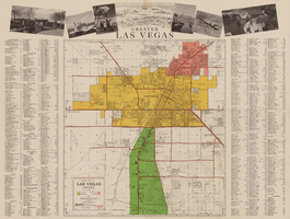
General map of Las Vegas, Nevada, circa 1957
Date
Description
Text
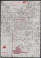
Map of metropolitan Las Vegas, Nevada, 1971
Date
Description
Text
Boxing officials in Las Vegas, Nevada, photograph and negative, 1929
Level of Description
Archival Collection
Collection Name: Elton and Madelaine Garrett Photograph and Architectural Drawing Collection
Box/Folder: Folder 07, Box 19
Archival Component
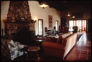
Walking Box Ranch: photographs
Date
Archival Collection
Description
10 color positive slides; Folder says: "Walking Box Ranch: Slides; 2004, undated"; Captured with Kodachrome Film; Typed on back of half of the slides: "July 2004; Michaels Photolab Inc." Folder from the Walking Box Ranch Collection (MS-00657).
Image
Walking Box Ranch Collection
Identifier
Abstract
The Walking Box Ranch Collection (1917-2011) includes material collected by the University of Nevada, Las Vegas (UNLV) Public Lands Institute on the Searchlight, Nevada ranch. Materials include a maps related to the construction and operation of the ranch, a pair of chaps owned by Rex Bell, Jr., and color slides of the ranch. Also included are photographic prints of Rex Bell and Rex Bell, Jr., and newsclippings related to the film and political career of Rex Bell. A small number of newsclippings pertain to the career of Rex Bell, Jr.
Archival Collection
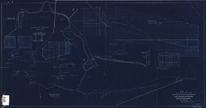
Blueprint showing proposed improvement of Las Vegas Springs, Las Vegas, Nevada, September 21, 1916
Date
Archival Collection
Description
'Exhibit A'. 'Approved Sept. 21, 1916.' '2-N-1719' handwritten in lower right corner. 'W.E.J."--Lower left corner. "L-44 - 50 to 61. T-75 - 17 & 46"--Upper left corner. Includes discharge figures and plans for improvements to springs. Scale [ca. 1:240]. 1 in. to 20 feet. -- Scale [ca. 1:2,400]. 1 in. to 200 ft. Vertical scale [ca. 1:48]. 1 in. to 4 feet. -- Scale [ca. 1:4,800]. 1 in. to 100 feet. 1 map. Contents: Detail at springs -- Profile -- Alignment.
Image

Topographic map of Nevada-California, Las Vegas quadrangle, 1951
Date
Description
Image
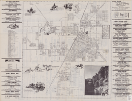
Street map of the city of Las Vegas, North Las Vegas, the "Strip", 1955
Date
Description
Image
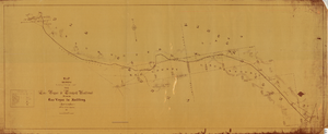
Map showing location of the Las Vegas & Tonopah Railroad from Las Vegas to Bullfrog, Nevada, 1906
Date
Archival Collection
Description
Image
