Search the Special Collections and Archives Portal

Search Results
Display    Results Per Page
Displaying results 15141 - 15150 of 15392

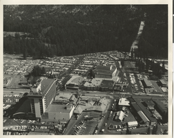
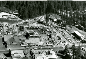
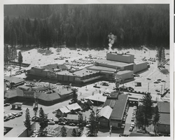
Aerial photograph of Harrah's Tahoe and Harrah's Stateline Club (Stateline, Nev.), 1961

Date

1961

Description

Aerial view of Harrah's Stateline Club adjacent to Harvey's Tahoe (lower left of photo) and Harrah's Tahoe (center of photo) on either side of Highway 50. Handwritten on original: "Air view 1961."
Site Name: Harrah's Tahoe
Address: 15 Highway 50

Image
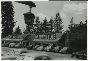
Aerial photograph of Harrah's Tahoe from the southwest (Stateline, Nev.), circa 1960

Date

1958 to 1961

Description

Aerial view of Harrah's Tahoe from the southwest.
Site Name: Harrah's Tahoe
Address: 15 Highway 50

Image
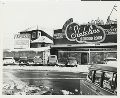
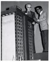
Photograph of Bill Harrah and Sammy Davis, Jr. looking at a model of the Harrah's Tahoe tower, circa 1972

Date

1971 to 1973

Description

Bill Harrah and Sammy Davis, Jr. looking at a model of the Harrah's Tahoe Tower.
Site Name: Harrah's Tahoe
Address: 15 Highway 50

Image
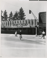
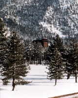
Photograph of Harrah's Tahoe tower from the west (Stateline, Nev.), after 1973

Date

1973 to 1983

Description

Winter view of the Harrah's Lake Tahoe tower from the west.
Site Name: Harrah's Tahoe
Address: 15 Highway 50

Image
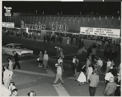
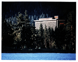
Photograph of Harrah's Tahoe from Lake Tahoe (Stateline, Nev.), after 1973

Date

1973 to 1983

Description

View of Harrah's Lake Tahoe from Lake Tahoe. Transcribed from photo sleeve: "Color photo of Harrah's Lake Tahoe."
Site Name: Harrah's Tahoe
Address: 15 Highway 50

Image
Aerial photograph of McWilliams' Original Las Vegas Townsite and Clark's Las Vegas Townsite, Las Vegas (Nev.), 1931

Date

1931

Description

Aerial view looking southwest with the original Las Vegas town site, McWilliams' Townsite on the right and the next development in the valley, Clark's Las Vegas Townsite in the left center.

Image

Photograph of Fremont Street, Las Vegas (Nev.), 1900-1925

Date

1900 to 1925

Description

Fremont Street looking east near its intersection with Main Street. Shows cars in the street, people on sidewalks, and American flag banners stretched across the street. Many businesses and their signs are visible including the Las Vegas Hotel, the Northern Hotel and the Nevada Bakery. Date estimated to be around 1930.
Site Name: Fremont Street (Las Vegas, Nev.)

Image

Transcript of interview with Randall "Randy" Walker by Stefani Evans, November 2, 2017

Date

2017-11-02

Description

In twenty-first-century, urban America, Randall "Randy" Walker is one of the few fathers who can say he raised his children in the same house in which he grew up. Walker did not inherit the house at 443 Republic Street, in Henderson. Instead, Walker bought the house from his parents after he graduated from Brigham Young University in Utah, worked with Exxon Oil Company in Houston, returned to Southern Nevada to work in his first government job as a budget analyst for Clark County, and sold the house he previously owned. He did not have to move his wife and children far-their previous home was at 442 Republic Street, directly across from his parents. In this oral history, Walker shares why his family came to Henderson in 1952, describes growing up in the small town of his youth, and tells what it was like to have his father as his high school Spanish teacher. He focuses on his career in government and how he applied his accountant mindset to the various positions he held with Clark County, the Las Vegas Metropolitan Police Department, the City of Las Vegas, and McCarran Airport. Along the way he shares his experiences with large governmental building projects such as the first 911 Call Center, the Downtown Transportation Center, the Regional Justice Center, and at McCarran Airport, the D v Gates, Terminal 3, and the airport tunnel and connector roads. He explains how his work with these various projects brought him into interaction with such diverse fields as architecture, accounting, construction, design, infrastructure, public art, public safety and local, state, and national politics. Throughout, Walker displays the collegial and common-sense approach to government, leadership, and problem solving that grounds the decisions he makes and explains why Richard Bunker wanted him at Clark County, why Clark County leaders recruited him to be county manager (and why that did not happen), and why McCarran Airport was able to accommodate without interruption Southern Nevada's record-breaking growth in residential and tourist traffic, and why, even in his absence, McCarran was the first major airport allowed to reopen following the 2001 September Eleventh terror attacks.

Text

Photographs of Glass Pool Inn signs, Las Vegas (Nev.), 2002

Date

2002

Description

Daytime views of the Glass Pool Inn signs on the Strip. Information about the sign is available in the Southern Nevada Neon Survey Data Sheet.
Site address: 4613 S Las Vegas Blvd
Sign details: Located on the very south end of Las Vegas Blvd the Glass Pool Inn boasts a Pylon/Pole sign along the east side of the Strip. Both the sign and the adjacent lounge, which holds vestiges of wall signs, are directly Northwest of the famed glass Portaled pool, where the establishment takes its name.
Sign condition: Structure 3 Surface 2 Lighting 2
Sign form: Pylon
Sign-specific description: The Glass Pool's main sign is a double-backed, double poled, internally lit pylon design. The top portion, a sculpted internally lit marquee in the classic kidney pool shape, reads "Glass Pool Inn." A smaller sign of similar water referenced design, sits below the main marquee. They are both contained in sheet metal framed painted blue. The bottom portion is comprised of a incandescent bulb LED matrix center, a Sheet metal message center containing a small plastic readerboard with vinyl letters, and a red neon sign for vacancy. The boxes or the message centers are also blue sheet metal.
Sign - type of display: Neon; Incandescent; Backlit
Sign - media: Steel; Plastic
Sign - non-neon treatments: Paint
Sign animation: none
Sign environment: The Glass Pool Inn sits on south end of the strip among the small dying hotels of Las Vegas Blvd's earlier history, it is one of the first signs you see traveling North on the strip entering town. Just north lies the beginning of the main flood of architecture from the modern strip; while to its south are the beginnings of the strip and the spawning new growth of Las Vegas. The Glass Pool stands in the unique position of being in that gateway of entering the Las Vegas Strip
Sign manufacturer: YESCO
Sign - date of installation: 1953
Sign - date of redesign/move: In 1989 when Steve Wynn was establishing the Mirage, there was another property which also had the name: the small southern Strip, roadside motel. When Wynn acquired the name the original Mirage simply changed its name to the Glass Pool Inn. The original sign was left in place, and simply remodeled to fit the new name of the motel. Permitted by the county to refurbish in December of 1988.
Sign - thematic influences: Water and the pool itself, kidney-shaped design.
Sign - artistic significance: The Glass Pool is an artistic artifact of the older smaller strip hotels. Artistically it is reminiscent of the roadside pole sign used to attract traffic. It represents one of the last strip roadside motels in that portion of the Strip.
Surveyor: Joshua Cannaday
Survey - date completed: 2002
Sign keywords: Pylon; Neon; Incandescent; Backlit; Steel; Plastic; Paint

Mixed Content