Search Results
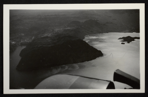
Aerial photograph of Hoover Dam, Colorado River, Lake Mead, Black Canyon, circa 1934-1935
Date
Archival Collection
Description
Image
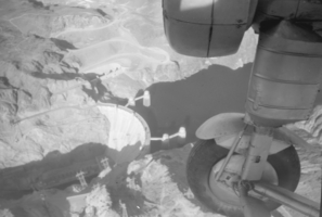
Film transparency showing an aerial view of Hoover Dam, circa late 1930s
Date
Archival Collection
Description
Image
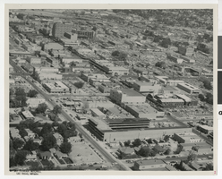
Film negatives of aerial views of the Westside, April 11, 1963
Date
Description
Series of 12 negatives from Nevada State Museum including aerial views of the Westside taken for Herbert Gerson, Executive Housing Director of Las Vegas, for purposes of urban renewal, April 11, 1963.
Image
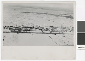
Aerial photograph of the El Rancho Vegas (Las Vegas), 1940s
Date
Archival Collection
Description
Aerial view of the El Rancho Vegas resort and surrounding desert in the the Las Vegas Valley in the 1940s. The ground is covered with snow.
Site Name: El Rancho Vegas
Address: 2500 Las Vegas Boulevard South
Image
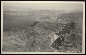
Aerial photograph of Hoover Dam, Lake Mead, Black Canyon, circa 1934-1935
Date
Archival Collection
Description
Image
Aerial photograph of Fremont Street with comments, Las Vegas, (Nev.), June 23, 1962
Date
Archival Collection
Description
Mixed Content
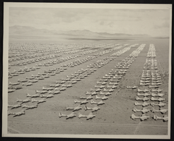
Aerial photograph of war surplus airplane storage site, Kingman, Arizona, circa 1940s-1950s
Date
Archival Collection
Description
Image
Aerial views of MGM (day and sunset): video, 1985 June 20
Level of Description
Scope and Contents
B-roll aerial footage taken from a helicopter of the Las Vegas Strip and then mostly 360 views of the MGM during the day and at sunset. Original media U-matic S, color, aspect ratio 4 x 3, frame size 720 x 486.
Archival Collection
Collection Name: The Production Company Audiovisual Collection
Box/Folder: Digital File 00
Archival Component
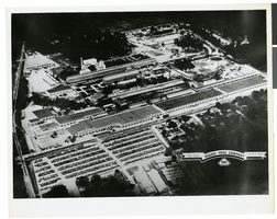
Aerial photograph of Hughes Tool Company, Houston, Texas, circa 1960s
Date
Archival Collection
Description
Image
Las Vegas, Nevada Cooper Aerial Survey books
Level of Description
Archival Collection
Collection Name: UNLV University Libraries Collection of Aerial Photographs
Box/Folder: N/A
Archival Component