Search Results
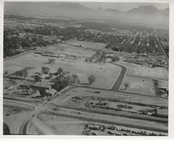
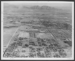
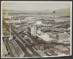
Aerial photograph of the Rose Garden Urban Renewal Project, North Las Vegas, circa October 1970
Date
1970-10
Archival Collection
Description
Aerial photo of the Rose Garden Urban Renewal Project.
Image
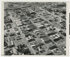
Aerial photograph of Fremont Street with comments, Las Vegas (Nev.), June 23, 1962
Date
1962-06-23
Archival Collection
Description
Aerial view of Fremont Street, looking from the east into the west. Photo taken on June 23, 1962. Stamped on the back: Jay Florian Mitchell Photographer 614 SO. 6th DU 4-5148 Las Vegas, Nevada Douglass Studio, INC. 614 South Sixth Dudley 4-5148 Las Vegas, Nevada. Comments on the photo written by Don Dobson are included.
Mixed Content
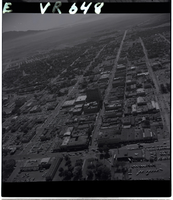
Film negative aerial view of Fremont Street, September 1, 1956
Date
1956-09-01
Description
Black and white negative aerial view of Fremont Street, showing Sal Sagev Hotel, Fremont Hotel, and Lucky Strike Club among others, dated September 1, 1956.
Image

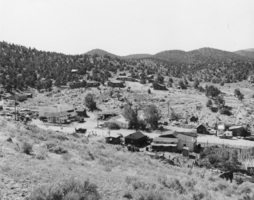
Aerial photograph of Tonopah (Nev.), 1900-1925
Archival Collection
Description
Inscription on reverse reads: " Tonopah Nevada Silver Queen Hotel stands above dump (on right) School lower right.
Image
Aerial view of Manhattan, Nevada: photographic print
Date
1940 to 1949
Archival Collection
Description
From the Nye County, Nevada Photograph Collection (PH-00221) -- Series VII. Other areas in Nye County -- Subseries VII.A. Boni Family (Manhattan, Nevada)
Image
Photograph of an aerial view of Sunrise Mountain, Las Vegas, 1964
Date
1964
Archival Collection
Description
An aerial view looking east to Sunrise Mountain with Vegas Heights is in bottom of picture, Miller Avenue by the railroad tracks, and Owens Avenue from east to west.
Image
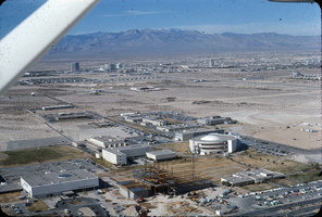
Slide of aerial view of University of Nevada, Las Vegas campus, circa 1971
Date
1970 to 1972
Archival Collection
Description
Aerial view, looking west, of University of Nevada, Las Vegas campus. Round building is Dickinson Library. Building in lower left is Moyer Student Union. Building under construction in foreground is Flora Dungan Humanities building. The Dunes Hotel, Caesars Palace, and the Sands Hotel can be seen in the distance.
Image
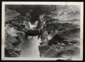
Aerial photograph of Hoover Dam with jet flow gates open, circa 1935-1936
Date
1935 to 1936
Archival Collection
Description
An aerial view of Boulder Dam with open jet flow gates (outlet works). Name officially changed to Hoover Dam in 1947.
Image
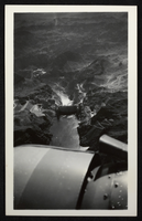
Aerial photograph of Hoover Dam with jet flow gates open, circa 1935-1936
Date
1935 to 1936
Archival Collection
Description
An aerial view of Boulder Dam with open jet flow gates (outlet works). Name officially changed to Hoover Dam in 1947.
Image
Aerial photograph of Las Vegas Boulevard, Las Vegas, Nevada, circa 1964
Date
1963 to 1965
Archival Collection
Description
Aerial photograph of a portion of the Las Vegas Strip, looking northeast in Las Vegas, Nevada. The New Frontier, marquee for the Silver Slipper, and Wilbur Clark's Desert Inn can be seen in the foreground; the La Concha, Riviera and Sahara hotels can be seen near the upper left; the Landmark Hotel tower (under construction) and dome-shaped Las Vegas Convention Center can be seen in the upper right. The KLAS-TV building, on E. Desert Inn Rd., and broadcast tower are seen in the upper center.
Image