Search Results
Fred and Maurine Wilson Photograph Collection
Identifier
Abstract
The Fred and Maurine Wilson Photograph Collection depicts the Wilson Family, events, and locations in Las Vegas, Nevada and the Southwestern United States from approximately 1860 to 1990. The photographs primarily depict early Las Vegas, including the Mormon Fort and Kiel Ranch; mines, towns, and railroads in Southern Nevada; the construction and planning of the Hoover (Boulder) Dam on the Colorado River; and the Wilson Family. The photographs also include prominent Las Vegas families such as the Park Family, aerial photographs of the city, landmarks on Fremont Street and downtown Las Vegas, and desert landscapes.
Archival Collection
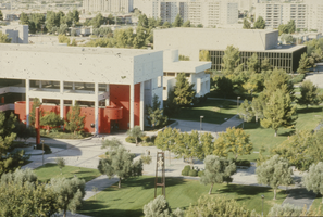
Slide of James R. Dickinson Library, William D. Carlson Education Building and Artemus W. Ham Concert Hall, University of Nevada, Las Vegas, circa 1981-1989
Date
Archival Collection
Description
Image

Photograph of the landing of Howard Hughes' Lockheed 14 aircraft, New York, July 14, 1938
Date
Archival Collection
Description
Image
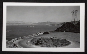
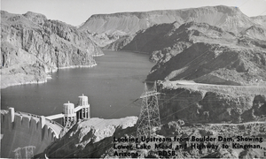
Photograph of Lakeview Point, Lake Mead, circa 1935
Date
Archival Collection
Description
Image
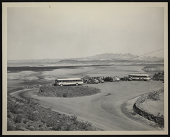
Photograph of Lakeview Point, Lake Mead, circa 1950s
Date
Archival Collection
Description
Image
Film transparency of Hoover Dam's upstream side, circa mid 1930s-1950s
Date
Archival Collection
Description
Image
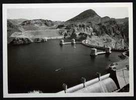
Photograph of intake towers and spillway, upstream face of Hoover Dam, circa 1935-1936
Date
Archival Collection
Description
Image
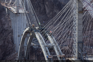
Photograph of arch construction for the Mike O'Callaghan-Pat Tillman Memorial Bridge, Nevada-Arizona border, June 29, 2009
Date
Archival Collection
Description
Image
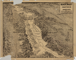
Map of Death Valley showing principal points of interest and Furnace Creek Inn, and Amargosa Hotel, circa 1930s
Date
Archival Collection
Description
Image