Search Results
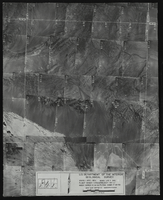
#01204: Campus Aerial taken by Cooper Aerial Surveys, Tucson Arizona, 1974 February 02
Level of Description
File
Archival Collection
University of Nevada, Las Vegas Creative Services Records (1970s)
To request this item in person:
Collection Number: PH-00388-01
Collection Name: University of Nevada, Las Vegas Creative Services Records (1970s)
Box/Folder: N/A
Collection Name: University of Nevada, Las Vegas Creative Services Records (1970s)
Box/Folder: N/A
Archival Component
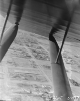
Film transparency of an aerial view, Las Vegas, 1929-1930
Date
1929 to 1930
Archival Collection
Description
An aerial view of Las Vegas as seen from inside an airplane.
Image
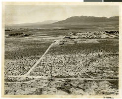
Aerial photograph of North Las Vegas, Nevada, June 5, 1973
Date
1973-06-05
Archival Collection
Description
Aerial view of North Las Vegas, Nevada. Handwritten on back of photograph: "Nellis Blvd. looking east."
Image
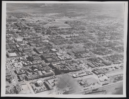
Photograph of an aerial view of Las Vegas (Nev.), January 22, 1947
Date
1947-01-22
Archival Collection
Description
An aerial view of Las Vegas showing most of downtown Las Vegas.
Image
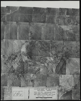
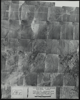
Aerial view of the Boulder Canyon quadrant in Arizona-Nevada: photographic print
Date
1950
Archival Collection
Description
From the Army Mapping Service Aerial Photographs of Southern and Western Nevada (PH-00285). Aerial photographs, composites, and indices. High altitude aerial photographs, Quad. Boulder Canyon, State: Arizona - Nevada. U.S. Geological Survey, Army Map Service. Flight Scale I-47200Project-GS-LJ. Index copied -8-26-50. Flying Comp. -7-26-50
Image
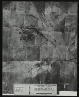
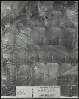
Aerial view of the Las Vegas quadrant in Arizona-Nevada: photographic print
Date
1950
Archival Collection
Description
From the Army Mapping Service Aerial Photographs of Southern and Western Nevada (PH-00285). Aerial photographs, composites, and indices. High altitude aerial photographs, Quad. Las Vegas 4. State: Arizona - Nevada. U.S. Geologial Survey, Army Map Service. Flight Scale I-47200Project-GS-LJ. Index copied -8-26-50. Flying Comp. -7-26-50
Image
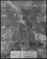
Aerial view of the Las Vegas quadrant in Arizona-Nevada: photographic print
Date
1950
Archival Collection
Description
From the Army Mapping Service Aerial Photographs of Southern and Western Nevada (PH-00285). Aerial photographs, composites, and indices. High altitude aerial photographs, Quad. Las Vegas 3. State: Arizona - Nevada. U.S. Geologial Survey, Army Map Service. Flight Scale I-47200Project-GS-LJ. Index copied -8-26-50. Flying Comp. -7-26-50
Image
Aerial view of the Las Vegas quadrant in Arizona-Nevada: photographic print
Date
1950
Archival Collection
Description
From the Army Mapping Service Aerial Photographs of Southern and Western Nevada (PH-00285). Aerial photographs, composites, and indices. High altitude aerial photographs, Quad. Las Vegas 2. State: Arizona - Nevada. U.S. Geologial Survey, Army Map Service. Flight Scale I-47200Project-GS-LJ. Index copied -8-26-50. Flying Comp. -7-26-50
Image
Aerial view of the Las Vegas quadrant in Arizona-Nevada: photographic print
Date
1950
Archival Collection
Description
From the Army Mapping Service Aerial Photographs of Southern and Western Nevada (PH-00285). Aerial photographs, composites, and indices. High altitude aerial photographs, Quad. Las Vegas 1. State: Arizona - Nevada. U.S. Geologial Survey, Army Map Service. Flight Scale I-47200Project-GS-LJ. Index copied -8-26-50. Flying Comp. -7-26-50
Image