Search Results
Aerial photograph of Hoover Dam and Lake Mead, 1935-1936
Date
1935 to 1936
Archival Collection
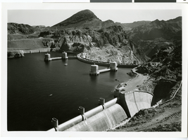
Description
Aerial view of the upstream side of Hoover Dam, showing the intake towers and spillways on Lake Mead. A few small watercraft are seen on the lake.
Image
Aerial view, 1950-1959
Level of Description
File
Archival Collection
Virginia "Teddy" Fenton Photograph Collection on the Hoover Dam and Boulder City, Nevada
To request this item in person:
Collection Number: PH-00022
Collection Name: Virginia "Teddy" Fenton Photograph Collection on the Hoover Dam and Boulder City, Nevada
Box/Folder: Folder 02
Collection Name: Virginia "Teddy" Fenton Photograph Collection on the Hoover Dam and Boulder City, Nevada
Box/Folder: Folder 02
Archival Component
Aerial view of Beatty, 1980
Level of Description
File
Archival Collection
Nye County, Nevada Photograph Collection
To request this item in person:
Collection Number: PH-00221
Collection Name: Nye County, Nevada Photograph Collection
Box/Folder: Folder 28
Collection Name: Nye County, Nevada Photograph Collection
Box/Folder: Folder 28
Archival Component
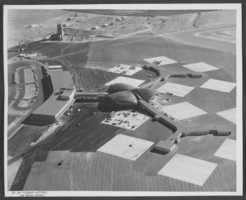
Photograph of aerial view, undated
Level of Description
Item
Archival Collection
Young Electric Sign Company (YESCO) Corporate Records
To request this item in person:
Collection Number: MS-00403
Collection Name: Young Electric Sign Company (YESCO) Corporate Records
Box/Folder: Box 10
Collection Name: Young Electric Sign Company (YESCO) Corporate Records
Box/Folder: Box 10
Archival Component
Aerials day shots of the Las Vegas Valley: video
Date
1988-03-01
Archival Collection
Description
Aerial day shots of the Las Vegas valley; includes the Strip, Desert Shores, Cashman field, and other locations across the valley. Original media U-matic S, color, aspect ratio 4 x 3, frame size 720 x 486. From The Production Company Audiovisual Collection (MS-00930) -- Digitized audiovisual material file.
Moving Image
Aerial photograph of McCarran Airport, Las Vegas, Nevada, circa 1963
Date
1962 to 1964
Archival Collection
Description
Aerial view of McCarran Airport in Las Vegas, Nevada.
Image
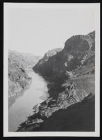
Aerial view of Colorado River and Black Canyon: photographic print
Date
1930 (year uncertain) to 1933 (year uncertain)
Archival Collection
Description
An aerial view of the Colorado River running through Black Canyon.
Image
Aerial photograph of North Las Vegas, Nevada, June 5, 1973
Date
1973-06-05
Archival Collection
Description
Aerial view of housing developments in North Las Vegas, Nevada. Handwritten on back of photograph: "Losee Road-Crestline Loop. Miller underpass."
Image
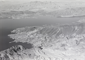
Film transparency of an aerial view of Lake Mead, circa 1930s-1950s
Date
1934 to 1959
Archival Collection
Description
Aerial view of Lake Mead and its shoreline.
Image
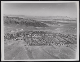
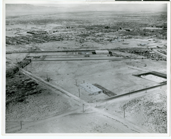
Photograph of aerial view of Boulder City (Nev.), 1947-01-22
Date
1947-01-22
Archival Collection
Description
An oversized picture of an aerial view of Boulder City.
Image