Search Results
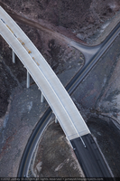
Photograph showing an aerial view of the Hoover Dam bypass highway intersecting with the original road leading to the dam, Arizona border, February 3, 2010
Date
2010-02-03
Archival Collection
Description
Photographer's notes: "Aerial view of the old road and the new bypass highway as they intersect on the Arizona side of the project, February 3, 2010." Site Name: Mike O'Callaghan-Pat Tillman Memorial Bridge
Image
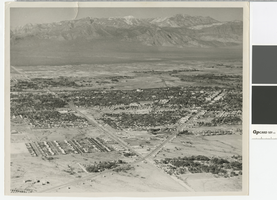
Aerial photograph of the Las Vegas Valley looking northwest towards Mount Charleston, 1945
Date
1945
Archival Collection
Description
Aerial view of the Las Vegas Valley looking northwest towards Mount Charleston.
Transcribed Notes: Handwritten inscription on back: Las Vegas about 1945 looking toward Charleston Mountains (North West). Road intersection in immediate foreground is that of Fremont Street from the right, Charleston Blvd from the left (Charleston Blvd runs due West); Stamped on back: Las Vegas News Bureau, Las Vegas - Nevada, Photographers Don English - Joe Buck - Jerry Abbott
Image
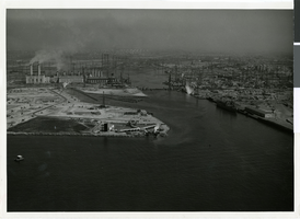
Aerial photograph of Terminal Island with the Hughes Flying Boat, Los Angeles Harbor, October 31, 1947
Date
1947-10-31
Archival Collection
Description
An aerial view of Terminal Island in the Los Angeles Harbor, showing Hughes Aircraft Company and the industrialization of the area.
Image
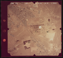
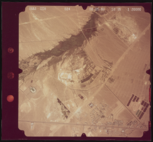
Aerial photograph of the streets Pueblo and Lake Mead, Henderson (Nev.), June 5, 1980
Date
1991-05-06
Archival Collection
Description
Photograph of the desert and the streets of Pueblo, Lake Mead Parkway, and Warm Springs.
Image
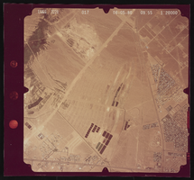
Aerial photograph of Boulder Highway and Lake Mead, Henderson (Nev.), June 5, 1980
Date
1991-05-13
Archival Collection
Description
Photograph of the desert and the streets Boulder Highway and Lake Mead Parkway.
Image
Aerial photograph of Boulder Highway and Lake Mead, Henderson (Nev.), June 5, 1980
Date
1991-05-17
Archival Collection
Description
Photograph of the desert and the streets Lake Mead Parkway and Boulder Highway.
Image
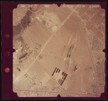
Aerial photograph of Pabco Road and Lake Mead, Henderson (Nev.), June 5, 1980
Date
1991-05-20
Archival Collection
Description
Photograph of the desert and the streets Lake Mead Parkway and Pabco Road.
Image
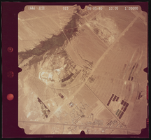
Aerial photograph of Pabco Road and Boulder Highway, Henderson (Nev.), June 5, 1980
Date
1991-05-20
Archival Collection
Description
Photograph of the desert and the streets Pabco Road and Boulder Highway.
Image
Aerial photograph of Boulder Highway and Pabco Road, Henderson (Nev.), June 5, 1980
Date
1991-05-20
Archival Collection
Description
Photograph of the desert and the streets Boulder Highway and Pabco Road.
Image
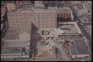
Color aerial view of the Fremont Hotel under construction. The Mint is visible in the background.
Date
1950 to 1969
Description
Arrangement note: Series V. Glass slidesSite name: Fremont Hotel and Casino (Las Vegas, Nev.)
Image