Search the Special Collections and Archives Portal
Search Results
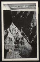
Aerial photograph of part of the Grand Canyon, circa 1930s-1940s
Date
1930 to 1949
Archival Collection
Description
An image showing an aerial view of part of the Grand Canyon.
Image
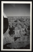
Aerial photograph of part of the Grand Canyon, circa 1930s-1940s
Date
1930 to 1949
Archival Collection
Description
An image showing an aerial view of part of the Grand Canyon.
Image
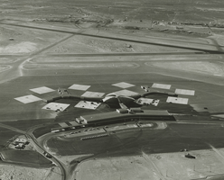
Aerial photograph of McCarran Airport, Las Vegas, Nevada, 1963
Date
1963
Archival Collection
Description
Aerial photograph of McCarran Airport and surrounding desert, Las Vegas, Nevada.
Image
Aerial views of MGM (day and sunset): video
Date
1985-06-20
Archival Collection
Description
B-roll aerial footage taken from a helicopter of the Las Vegas Strip and then mostly 360 views of the MGM during the day and at sunset. Original media U-matic S, color, aspect ratio 4 x 3, frame size 720 x 486. From The Production Company Audiovisual Collection (MS-00930) -- Digitized audiovisual material file.
Moving Image
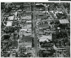
Aerial photograph of downtown Las Vegas, circa 1930s-1940s
Date
1930 to 1949
Archival Collection
Description
Aerial view, downtown. The center vertical street is Fremont Street and at the top of the page is Main Street.
Image
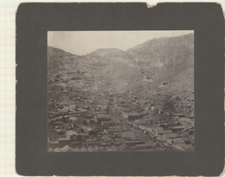
Aerial photograph of Pioche, Nevada, circa 1880s-1890s
Date
1880 to 1899
Archival Collection
Description
An aerial view of Pioche, Nevada. The Dexter Stables, Marysville Hotel, J. J. Halpin &Co. Hardware and another hardware store, furniture stores and a tobacco store are identified.
Image

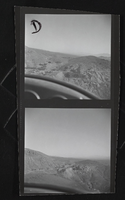
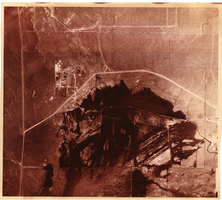
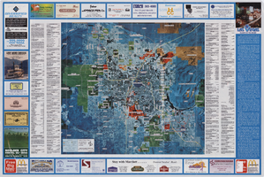
Aerial map of the Las Vegas Valley, with map of Las Vegas, 1992
Date
1992
Description
2 maps on 1 sheet : both sides, col. ; 47 x 51 cm. and 54 x 71 cm. on sheet 61 x 91 cm. Photomap. Includes text about Las Vegas, list of businesses with coordinates for map on verso, and advertisements. On verso: Bird's-eye view map of a section of unincorporated Las Vegas east of the Strip between Charleston and Sunset oriented with north to left and drawn by Jack Tavenner in 1992. Shows locations of schools, lists Boulder City merchants, and includes advertisements. Original Publisher: Landiscor Aerial Photo
Image
Pagination
Refine my results
Content Type
Creator or Contributor
Subject
Archival Collection
Digital Project
Resource Type
Year
Material Type
Place
Language
Records Classification
