Search Results
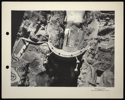
Aerial photograph of Hoover Dam, circa 1935-1936
Date
1935 to 1936
Archival Collection
Description
An aerial view of Boulder Dam with open jet flow gates (outlet works). Name officially changed to Hoover Dam in 1947.
Image
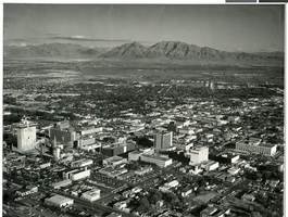
Aerial photograph of downtown Las Vegas, circa 1966-1969
Date
1966 to 1969
Archival Collection
Description
Aerial view of downtown Las Vegas, looking southeast.
Image
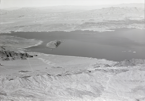
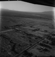
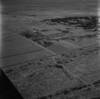
Film transparency of an aerial view of Lake Mead, circa 1930s
Date
1930 to 1939
Archival Collection
Description
Aerial view of Lake Mead and its shoreline.
Image
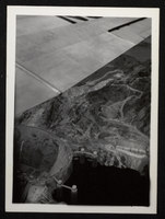
Aerial photograph of Hoover Dam, circa 1933-1935
Date
1934 to 1935
Archival Collection
Description
Aerial view of the nearly completed Hoover Dam in Black Canyon prior to the release of water.
Image
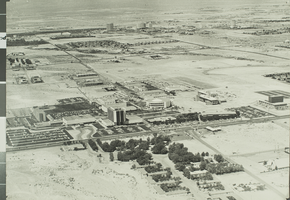
Aerial photograph of University of Nevada, Las Vegas, circa 1972
Date
1972
Archival Collection
Description
An aerial view of the University of Nevada, Las Vegas (UNLV). The Las Vegas Strip is visible in background.
Image
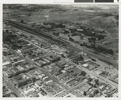
Aerial photograph of Las Vegas (Nev.), circa 1940
Date
1939 to 1941
Archival Collection
Description
Aerial view of depot yards, roundhouse, and shops in the growing city of Las Vegas.
Image
Aerial footage of Vegas World: video
Date
1988-08-30
Archival Collection
Description
B-roll footage of Vegas World during different times of day and angles; 360 views and distance shot from father down Las Vegas Blvd; neon signs lit up at night. Original media VHS, color, aspect ratio 4 x 3, frame size 720 x 486. From the Bob Stupak Professional Papers (MS-01016) -- Professional papers -- Audiovisual material -- Digitized audiovisual clips file.
Moving Image
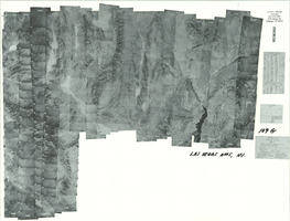
Index to aerial photographs of Las Vegas, Nevada: photographic print
Date
1952 to 1954
Archival Collection
Description
From the Army Mapping Service Aerial Photographs of Southern and Western Nevada (PH-00285). Aerial photographs, composites, and indices. Geological Survey, Army Map Service. Western US. Project No. 109. Area G.
Image