Search Results
Film transperancy of an aerial view of Las Vegas, Nevada, circa 1929-1930
Date
Archival Collection
Description
Image

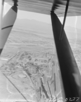
Film transparency of an aerial view of Las Vegas, Nevada, circa 1929-1930
Date
Archival Collection
Description
Image
Aerial views of Las Vegas Strip: video
Date
Archival Collection
Description
Aerial views of the Las Vegas Strip that starts in color and then shifts to black and white; includes views of MGM Grand, Vegas World, Sahara, Wet 'n Wild, Riveria, Circus Circus; switches back to color and the remainder is 360 views of the MGM Grand tower, marquee with Jubilee! sign, and neon signs during day and slowly fading into night shots. Original media 1 Inch SMPTE Type B, color, aspect ratio 4 x 3, frame size 720 x 486. From The Production Company Audiovisual Collection (MS-00930) -- Digitized audiovisual material file.
Moving Image
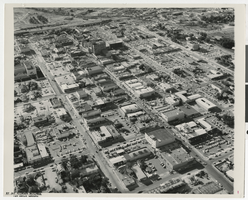
Aerial photograph of Fremont Street, Las Vegas (Nev.), June 23, 1962
Date
Description
Image
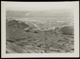
Aerial photograph of Boulder City (Nev.), circa 1933
Date
Archival Collection
Description
Image
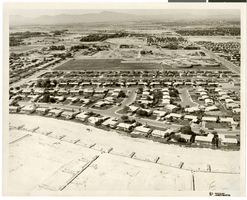
Aerial photograph of North Las Vegas, Nevada, June 5, 1973
Date
Archival Collection
Description
Image
Aerial photograph of Disneyland, Anaheim, California, 1950s
Level of Description
Archival Collection
Collection Name: Mary and Arthur Ackerman Aerial Photograph Collection
Box/Folder: Folder 01
Archival Component

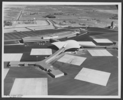
Aerial photograph of McCarran Airport and surrounding area, Las Vegas, Nevada, circa 1963
Date
Archival Collection
Description
Image
Aerial photograph of McCarran Airport and surrounding area, Las Vegas, Nevada, circa 1963
Date
Archival Collection
Description
Image
Las Vegas diagrammed aerial by Cooper Aerial Surveys Co. (scaled at 2 inches = 1 mile): photographic print, 1984 September
Level of Description
Archival Collection
Collection Name: UNLV University Libraries Collection of Aerial Photographs
Box/Folder: Flat File 03
Archival Component