Search the Special Collections and Archives Portal
Search Results
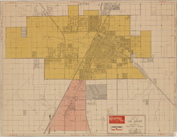
Map of Las Vegas and vicinity, Clark County, Nevada, November 1952
Date
1952-11
Description
'Copyright 1950. 3rd issue, November 1952.'
Image

Street map of the city of Las Vegas & vicinity, showing streets, main roads and recreation areas, 1954
Date
1954
Description
7 maps on 3 sheets, 2 leaves ; 21 x 31 cm. or smaller on sheets 22 x 35 cm. folded to 22 x 13 cm. in paper cover. Title from cover. Copyright held by James E. Stringer. 1st ed. Includes maps of North Las Vegas, the Strip and Vegas Heights and Meadow Acres. Includes key to map coordinates. Includes index. "Map of Las Vegas & Vicinity showing streets, main roads, and recreation areas." Original publisher: R.W. Baldwin.
Image
Reference materials: interview questions, TTO Archives Committee overview, October 2019 Pink Pages, 2019
Level of Description
File
Archival Collection
Alpha Kappa Alpha Sorority, Incorporated, Theta Theta Omega Chapter Records
To request this item in person:
Collection Number: MS-01014
Collection Name: Alpha Kappa Alpha Sorority, Incorporated, Theta Theta Omega Chapter Records
Box/Folder: Digital File 00
Collection Name: Alpha Kappa Alpha Sorority, Incorporated, Theta Theta Omega Chapter Records
Box/Folder: Digital File 00
Archival Component

Map of greater Las Vegas, 1960
Date
1960
Description
55 x 44 cm., folded to 30 x 12 cm. Relief shown by spot heights. Includes notes and quotations. Includes indexes. Panel title: Front Boy's official 1962-1963 edition street map: detailed guide of North Las Vegas, Las Vegas, Paradise Valley and vicinity. 1962-1963 ed. Original publisher: Front Boy Service Co..
Image
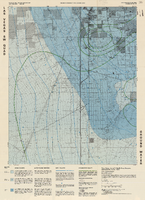
Topographic map of groundwater in the southwest quadrangle of Las Vegas, Nevada, 1985
Date
1985
Description
'Las Vegas Area Map 3Bf.' 'Prepared in cooperation with the U.S. Geological Survey.' ' Water Resources Division, U.S. Geological Survey, Carson City, Nevada.' Scale 1:24,000 (W 115°15´00?--W 115°07´30? / N 36°07´30?--N 36°00´00?). Series: Las Vegas area map ; 3Bf. Urban area maps. Las Vegas area map ; 3Bf. Relief shown by contour lines and spot heights. Title in right and left margins: Las Vegas SW quad : ground water. Title on publications list on Nevada Bureau of Mines and Geology website: Groundwater map of the Las Vegas SW quadrangle. Series: Urban area maps [Las Vegas area map] from list of publications on Nevada Bureau of Mines and Geology website. Nevada Bureau of Mines and Geology
Text
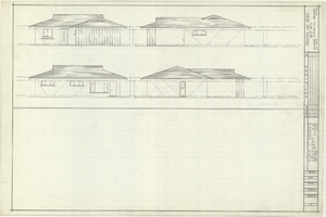
Architectural drawings of residential home in Las Vegas, Nevada, exterior elevations, 1955
Date
1955
Archival Collection
Description
Drawings of exterior elevations of a ranch-style residential home in the Greater Las Vegas development in Las Vegas, Nevada. Handwritten underneath drawings at right: "Plan 14C - Elev. C."
Site Name: Greater Las Vegas
Image
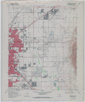
Topographic map of the northeast quadrangle of the metropolitan Las Vegas, Nevada area, 1967
Date
1967
Description
Scale 1:24,000 ; polyconic proj. (W 115°730--W 115°0000/N 36°1500--N 36°730) ; 1 map : col. ; 58 x 47 cm ; 7.5 minute series (topographic) ; Relief shown by contours and spot heights ; Filing title: Las Vegas NE, Nev ; "AMS 2956 II NE--Series V896." ; Contour interval 20 feet ; "Topography by photogrammetric methods from aerial photographs taken 1965. Field checked 1967." ;Includes quadrangle location map ; Interior--Geological Survey
Image
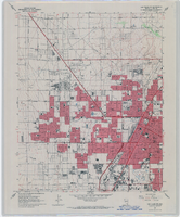
Topographic map of the northwest quadrangle of the metropolitan Las Vegas, Nevada area, 1967
Date
1967
Description
Scale 1:24,000 ; polyconic proj. (W 115°1500--W 115°730/N 36°1500--N 36°730) ; 1 map : col. ; 58 x 47 cm ; 7.5 minute series (topographic) ; Relief shown by contours and spot heights ; Filing title: Las Vegas NW, Nev ; "AMS 2956 II NW--Series V896." ; Contour interval 10 feet ; "Topography by photogrammetric methods from aerial photographs taken 1965. Field checked 1967." ; Includes quadrangle location map ; Interior--Geological Survey
Image
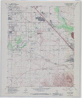
Topographic map of the southeast quadrangle of the metropolitan Las Vegas, Nevada area, 1967
Date
1967
Description
Scale 1:24,000 ; polyconic proj. (W 115°0730--W 115°0000/N 36°0730--N 36°0000) ; 1 map : col. ; 58 x 47 cm ; 7.5 minute series (topographic) ; Relief shown by contours and spot heights ; Filing title: Las Vegas SE, Nev ; "AMS 2956 II SE--Series V896." ; Contour interval 20 feet ; "Topography by photogrammetric methods from aerial photographs taken 1965. Field checked 1967." ; Includes quadrangle location map ; Interior--Geological Survey
Image
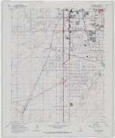
Topographic map of the southwestern quadrangle of the metropolitan Las Vegas, Nevada area, 1967
Date
1967
Description
Scale 1:24,000 ; polyconic proj. (W 115°1500--W 115°0730/N 36°0730--N 36°0000) ; 1 map : col. ; 58 x 47 cm ; 7.5 minute series (topographic) ; Relief shown by contours and spot heights ; Filing title: Las Vegas SW, Nev ; "AMS 2956 II SW--Series V896." ; Contour interval 10 feet ; "Topography by photogrammetric methods from aerial photographs taken 1965. Field checked 1967." ; Includes quadrangle location map ; Interior--Geological Survey
Image
Pagination
Refine my results
Content Type
Creator or Contributor
Subject
Archival Collection
Digital Project
Resource Type
Year
Material Type
Place
Language
Records Classification
