Search Results

Redevelopment plan map for downtown Las Vegas, Nevada, November 18, 1987
Date
1987-11-18
Description
Scale [ca. 1:12,000. 1 inch equals approx. 1,000 feet]. 1 map ; on sheet 61 x 46 cm. "Nov. 18, 1987." "All land use designations on this map are to be interpreted in conformance with the community profiles component of the Las Vegas General Plan." City of Las Vegas?.
Image
Jacob Wohl on Twitter: "While brave law enforcement heroes save hundreds of lives in Las Vegas, thugs in the NFL continue to slander law enforcement and our flag https://t.co/ZjfJx8eMiH": archived website, 2017
Level of Description
Other Level
Archival Collection
Web Archive on the October 1, 2017 Shooting in Las Vegas, Nevada
To request this item in person:
Collection Number: MS-00866
Collection Name: Web Archive on the October 1, 2017 Shooting in Las Vegas, Nevada
Box/Folder: N/A
Collection Name: Web Archive on the October 1, 2017 Shooting in Las Vegas, Nevada
Box/Folder: N/A
Archival Component

Plat showing original townsite and subdivisions, Las Vegas, Lincoln County, Nevada, May 1905
Date
1905-05
Description
Land owned by the San Pedro, Los Angeles & Salt Lake Railroad is outlined. Scale: [ca. 1:12,000]. 1 inch = 1,000 feet. Cadastral map. Blueline print. Additional copy available in the J.T. McWilliams manuscript collection
Image
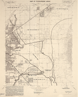
Las Vegas NE quadrangle
Date
1973
Description
'Prepared by the U.S. Department of the Interior, Geological Survey, in cooperation with the U.S. Department of Housing and Urban Development, Federal Insurance Administration. 1973.'
Image
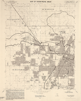
Las Vegas NW quadrangle
Date
1973
Description
'Prepared by the U.S. Department of the Interior, Geological Survey, in cooperation with the U.S. Department of Housing and Urban Development, Federal Insurance Administration. 1973.'
Image
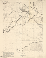
Las Vegas SE quadrangle
Date
1973
Description
'Prepared by the U.S. Department of the Interior, Geological Survey, in cooperation with the U.S. Department of Housing and Urban Development, Federal Insurance Administration. 1973.'
Image

Las Vegas SW quadrangle
Date
1973
Description
'Prepared by the U.S. Department of the Interior, Geological Survey, in cooperation with the U.S. Department of Housing and Urban Development, Federal Insurance Administration. 1973.'
Image
"I’m black. I’m a peacebuilder. I want your help." UNLV Today op-ed by Jessica Walters Murrey: archived website
Level of Description
Other Level
Archival Collection
UNLV Black Lives Matter Web Archive
To request this item in person:
Collection Number: UA-00110
Collection Name: UNLV Black Lives Matter Web Archive
Box/Folder: N/A
Collection Name: UNLV Black Lives Matter Web Archive
Box/Folder: N/A
Archival Component

Map of the Las Vegas Strip, May 1950
Date
1950-05
Description
Scale [ca. 1:10,200. 1 in. to approx. 850 ft.] ; 1 map : col. ; 54 x 28 cm ; Cadastral map ; "May 1950." Campbell Realty.
Image

Map of Las Vegas Valley showing artesian wells, circa 1920
Date
1918 to 1922
Description
Scale not given ; 1 map ; 66 x 55 cm ; Blueline print ; Cadastral map ; Includes township and range grid ; Includes quotations McWilliams?
Image