Search Results
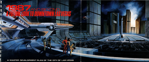
Proposal for 1987 and beyond: a future look to Downtown Las Vegas, February 1, 1987
Date
1987
Description
Overview of a master development plan for the City of Las Vegas from 1987.
Image
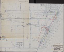
Map of water pipelines owned by or to be sold to the Las Vegas Valley Water District, March 1, 1953
Date
1953-03-01
Archival Collection
Description
Map shows portions of pipelines to be sold to the Las Vegas Valley Water District, pipelines connected to those to be sold to the District that will be retained by the railroad companies, and privately-owned pipelines connecting to those to be sold to the District. 'Exhibit D.' 'March 1, 1953.' 'I-128.' Las Vegas Land and Water Company?
Image

Map of Las Vegas Valley, Clark County, Nevada, October 1, 1940
Date
1940-10-01
Archival Collection
Description
'Compiled by C.D. Baker, Civil Engineer, State Water Right Surveyor, Mineral Surveyor, Gen. Land Office, Las Vegas, Clark County, Nevada. Oct. 1, 1940.' Yellow lines show boundary of the proposed water district; green lines show boundary of the city of Las Vegas; red line shows the Union Pacific Railroad route.
Image
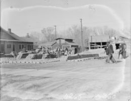
Film transparency of construction, Las Vegas, 1930
Date
1930
Archival Collection
Description
The construction of what is most likely a house in Las Vegas, Nevada.
Image
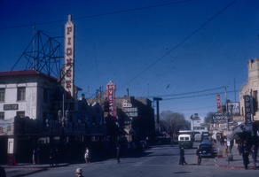
Slide of downtown Las Vegas, circa 1940s
Date
1942 to 1949
Archival Collection
Description
An image of Fremont Street in downtown Las Vegas during the day.
Image
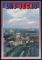
The Las Vegas Strip, image 004: postcard
Date
1989 (year approximate) to 2000 (year approximate)
Archival Collection
Description
Looking north-northwest at sunrise up the Las Vegas Strip.
Image
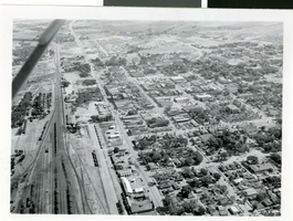
Aerial photograph of Las Vegas, circa 1930s
Date
1930 to 1939
Archival Collection
Description
An aerial view of Las Vegas, with houses and railroad tracks visible.
Image
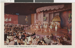
Photograph of a show, Las Vegas (Nev.), 1940s
Date
1940 to 1949
Description
A colorful stage production performs somewhere on the Las Vegas strip.
Image

Photograph of Julian Moore, Las Vegas (Nev.), 1955-1965
Date
1955 to 1965
Archival Collection
Description
Portrait of Julian Moore, taken by Nevada Studios, Las Vegas.
Image
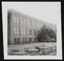
Las Vegas High School: photographic print
Date
1978 (year approximate)
Archival Collection
Description
From the Historic Building Survey Photograph Collection (PH-00345). Las Vegas High School, rear of administration building, 317 South 7th Street, Las Vegas, Nevada.
Image