Search Results
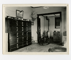
Photograph of Edwin S. Giles survey office, Goldfield (Nev.), 1900-1925
Archival Collection
Description
White Death Valley holly in Indian basket on wall. Drawers were 40" deep and went through the wall.
Image
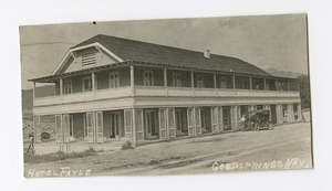
Photograph of an automobile outside the Hotel Fayle, Goodsprings (Nev.), 1900-1925
Archival Collection
Description
Site Name: Hotel Fayle (Goodsprings, Nev.)
Image
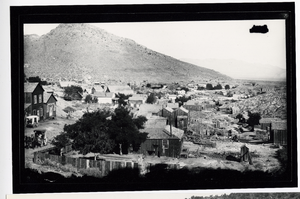
Photograph of Pioche with a horse-drawn carriage and residences,Treasure Hill (Nev.), Pioche (Nev.), 1900-1925
Date
1900 to 1925
Archival Collection
Description
Photograph of Pioche with a horse-drawn carriage and residences,Treasure Hill (Nev.), Pioche (Nev.), 1900-1925
Image
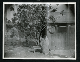
Photograph of a Native American woman sitting on a bench under a tree, Las Vegas (Nev.), 1900-1925
Date
1900 to 1925
Archival Collection
Description
Photograph of a Native American woman sitting on a bench under a tree, Las Vegas (Nev.), 1900-1925
Image
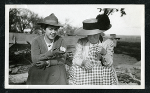
Photograph of two women wearting hats while sitting outdoors, Las Vegas (Nev.), 1900-1925
Date
1900 to 1925
Archival Collection
Description
Photograph of two women wearting hats while sitting outdoors, Las Vegas (Nev.), 1900-1925
Image
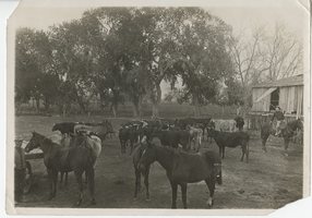
Photograph of horses and cattle on the Las Vegas Ranch, Las Vegas (Nev.), 1900-1925
Date
1900 to 1925
Archival Collection
Description
Date estimated between 1900-1905.
Site Name: Las Vegas Ranch (Las Vegas, Nev.)
Site Name: Las Vegas Ranch (Las Vegas, Nev.)
Image
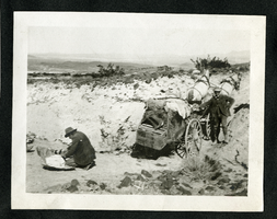
Postcard of men repacking a wagon after crossing a wash, Meadow valley Wash (Nev.), 1900-1925
Date
1900 to 1925
Archival Collection
Description
Postcard of men repacking a wagon after crossing a wash, Meadow valley Wash (Nev.), 1900-1925
Image
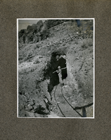
Photograph of a man carrying a shovel standing at the rail tunnel entrance, Las Vegas (Nev.), 1900-1925
Date
1900 to 1925
Archival Collection
Description
Photograph of a man carrying a shovel standing at the rail tunnel entrance, Las Vegas (Nev.), 1900-1925
Image
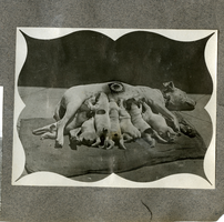
Photograph of a mother dog marked with Salt Lake Route logo nursing her pups, 1900-1925
Date
1900 to 1925
Archival Collection
Description
Photograph of a mother dog marked with Salt Lake Route logo nursing her pups, 1900-1925
Image
Book, A Lady in Boomtown: Miners and Manners on the Nevada Frontier, 1968
Date
1968
Description
Book, A Lady in Boomtown: Miners and Manners on the Nevada Frontier, 1968
Text