Search Results
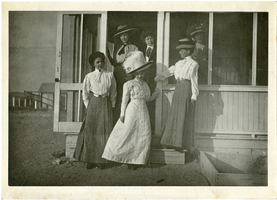
Photograph of women posing on cottage steps, Goldfield (Nev.), early 1900s
Date
1900 to 1925
Archival Collection
Description
Photograph of women posing on cottage steps, Goldfield (Nev.), early 1900s
Image
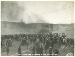
Photograph of Goldfield Hotel fire (Nev.), November 17, 1906
Date
1906-11-17
Archival Collection
Description
Hotel Goldfield destroyed by fire Nov. 17th 1906
Site Name: Goldfield Hotel (Goldfield, Nev.)
Site Name: Goldfield Hotel (Goldfield, Nev.)
Image
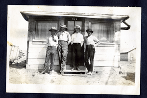
Photograph of C.A. Earle Rinker and three other men outside a miner's cottage, Goldfield (Nev.), early 1900s
Date
1900 to 1925
Archival Collection
Description
Rinker is at the left
Image
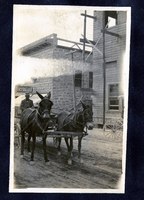
Photograph of Walt MacMaster driving a mule team, Goldfield (Nev.), early 1900s
Date
1900 to 1925
Archival Collection
Description
Photograph of Walt MacMaster driving a mule team, Goldfield (Nev.), early 1900s
Image
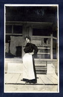
Photograph of a woman standing in front of a store, Goldfield (Nev.), early 1900s
Date
1900 to 1925
Archival Collection
Description
Photograph of a woman standing in front of a store, Goldfield (Nev.), early 1900s
Image
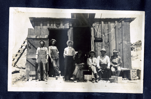
Photograph of men outside mine building, Goldfield (Nev.), early 1900s
Date
1900 to 1925
Archival Collection
Description
Photograph of men outside mine building, Goldfield (Nev.), early 1900s
Image
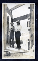
Photograph of two men smoking outside a building, Goldfield (Nev.), early 1900s
Date
1900 to 1925
Archival Collection
Description
Photograph of two men smoking outside a building, Goldfield (Nev.), early 1900s
Image
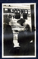
Photograph of two men outside of Lincoln Davis' brokerage office, Goldfield (Nev.), early 1900s
Date
1900 to 1925
Archival Collection
Description
Site Name: Lincoln Davis Brokerage Office (Goldfield, Nev.)
Image
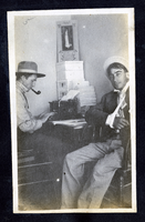
Photograph of C. A. Earle Rinker and George Lockhart in an office, Goldfield (Nev.), early 1900s
Date
1900 to 1925
Archival Collection
Description
Photograph of C. A. Earle Rinker and George Lockhart in an office, Goldfield (Nev.), early 1900s
Image
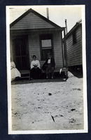
Photograph of people sitting on a cottage porch, Goldfield (Nev.), early 1900s
Date
1900 to 1925
Archival Collection
Description
Photograph of people sitting on a cottage porch, Goldfield (Nev.), early 1900s
Image