Search Results
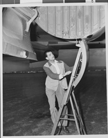
Photograph of Howard Hughes, circa 1947
Date
1947
Archival Collection
Description
A view of Howard Hughes preparing to fly the Air Force test plane.
Image
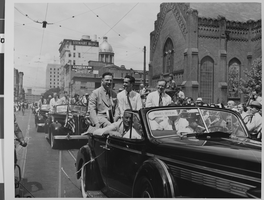
Photograph of a parade for Howard Hughes, Chicago, 1938
Date
1938
Archival Collection
Description
Howard Hughes at a parade held for himself in Chicago.
Image

Audrey and letter carriers food drive, Culinary Union, Las Vegas (Nev.), 1997 (folder 1 of 4), image 19
Date
1997
Description
Arrangement note: Series II. Public Events
Image
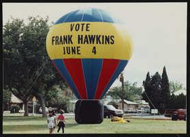
Frank Hawkins city council election rally, Culinary Union, Las Vegas (Nev.), 1990s (folder 1 of 1), image 3
Date
1990 to 1999
Description
Arrangement note: Series II. Public Events
Image
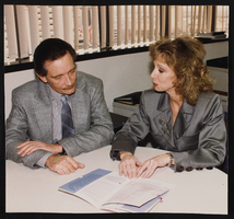
Jim Arnold with other workers, Culinary Union, Las Vegas (Nev.), 1990-2006 (folder 1 of 1), image 11
Date
1990 to 2006
Description
Arrangement note: Series III. Internal: Work
Image
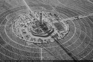
Photograph of Unit 2 power block construction, April 11, 2012
Date
2012-04-11
Archival Collection
Description
Unit 2 power block construction with tower, crane, and vehicles of construction workers
Image
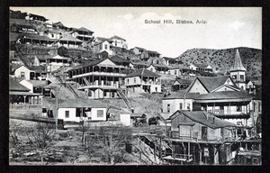
Postcard of Bisbee, (Ariz,), 1900-1920
Date
1900 to 1920
Archival Collection
Description
Postcard of Bisbee, (Ariz,), 1900-1920
Image
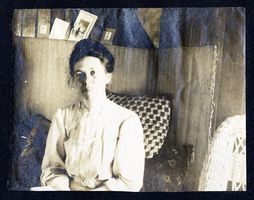
Photograph of Myrta Fenwick, 1900-1920
Date
1900 to 1920
Archival Collection
Description
Photograph of Myrta Fenwick, 1900-1920
Image
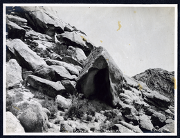
Photograph of Gothic Rock, Goldfield (Nev.), early 1900s
Archival Collection
Description
Caption: Gothic Rock Lone Mts Nev.
Image
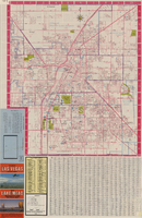
Las Vegas street map and Lake Mead Recreation Area pictorial map, 1979
Date
1979
Description
'Covering Las Vegas, North Las Vegas, Sunrise Manor, Winchester, Paradise and East Las Vegas from Craig Road on the north to Sunset Road on the south and Nellis Boulevard on the east to Jones Boulevard on the west' -- front panel. 'This tourist map has been published by CreaTours, Inc. in co-operation with the North Las Vegas Chamber of Commerce." 3rd ed. Scale [ca. 1:31,680. 1 in. to approx. 0.5 miles]. Includes indexes. Pictorial map of Lake Mead National Recreation Area on verso, by Cliff Segerblom. 'Lithographed by Creel Printing Company, Las Vegas, Nev.' Second edition, copyright 1977. 'Map not to scale due to artistic license.' Advertisements on map verso.
Text