Search Results
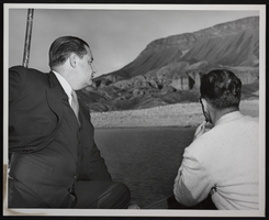
Photograph of two unidentified men at the decennial, Hoover Dam, circa October 1946
Date
1946
Archival Collection
Description
An image of unidentified men in a boat on Lake Mead during the Boulder Dam decennial event. Note: Boulder Dam was officially renamed Hoover Dam in 1947.
Image
Bramlet, Al, 1917-1977
Elmer “Al” Bramlet (1917-1977) was a prominent union leader in Las Vegas, Nevada during the middle of the 20th century. As the union leader of the Culinary Workers Union Local 226, Bramlet made significant contributions to the union and its members. However, Bramlet also amassed various enemies during his time as union leader, which led to his early death in 1977 at the hands of Thomas Hanley.
Person
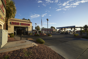
Gas station, store and car wash on West Sahara Avenue and Buffalo Drive, looking northeast, Las Vegas, Nevada: digital photograph
Date
2017-10-11
Archival Collection
Description
A Terrible Herbst gas station, convenance store, and car wash occupies the northwest corner of West Sahara Avenue and Buffalo Drive.
Image
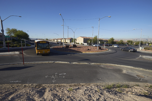
School bus using the roundabout that makes up the intersection of East Sahara Avenue and Hollywood Boulevard, looking south, Las Vegas, Nevada: digital photograph
Date
2017-09-29
Archival Collection
Description
A school bus uses the intersection of East Sahara Avenue and Hollywood Boulevard.
Image
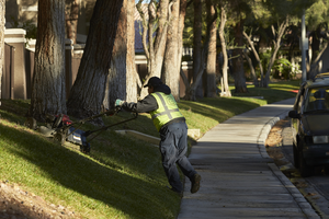
Landscape worker mowing grass on Grand Canyon Drive south of West Sahara Avenue, looking north, Las Vegas, Nevada: digital photograph
Date
2017-10-10
Archival Collection
Description
A worker mows grass along Grand Canyon Drive south of West Sahara Avenue at the Reflections at the Lakes Apartments.
Image
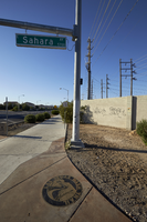
Trail maker at East Sahara Avenue and Sloan Lane, looking south, Las Vegas, Nevada: digital photograph
Date
2017-09-28
Archival Collection
Description
A marker for the Las Vegas Wash Trail is embedded in the sidewalk on the southwest corner of East Sahara Avenue and Sloan Lane.
Image
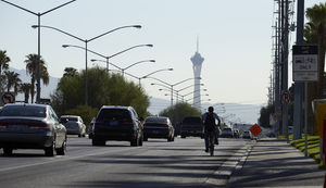
Bicyclist and cars on West Sahara Avenue east of Jones, looking east, Las Vegas, Nevada: digital photograph
Date
2017-09-20
Archival Collection
Description
A bicyclist looks back at traffic as they head eastbound on West Sahara Avenue. The Stratosphere Tower can be seen in the distance.
Image
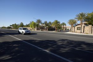
Casa Bella Estates on Cimarron Road north of West Sahara Avenue, looking southwest, Las Vegas, Nevada: digital photograph
Date
2017-10-11
Archival Collection
Description
A car passes in front of Casa Bella Estates off Cimarron Road north of West Sahara Avenue.
Image
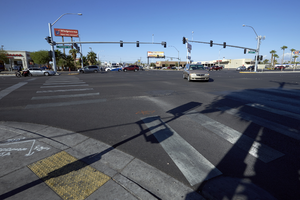
Traffic at the intersection of Boulder Highway / Fremont Street near East Sahara Avenue looking west, Las Vegas, Nevada: digital photograph
Date
2017-09-14
Archival Collection
Description
Traffic navigates the intersection of Boulder Highway / Fremont Street and East Sahara Avenue.
Image
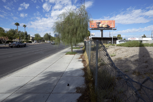
Vacant land on East Sahara Avenue near Maryland Parkway looking west, Las Vegas, Nevada: digital photograph
Date
2017-09-13
Archival Collection
Description
A vacant lot on the northeast corner of Pardee Place and East Sahara Avenue east of Maryland Parkway.
Image