Search Results

Photograph showing an aerial view of the Mike O'Callaghan-Pat Tillman Memorial Bridge casting a shadow over the face of Hoover Dam, Nevada-Arizona border, January 14, 2011
Date
2011-01-14
Archival Collection
Description
Photographer's notes: "A late afternoon shadow reveals the connection between the bridge and dam. Note: This was one of the last photographs from the bridge project. When I headed back to the airport, the project's photography was complete." Site Name: Mike O'Callaghan-Pat Tillman Memorial Bridge
Image
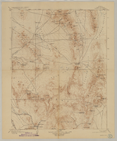
Map of Kawich Quadrangle, Nye County, Nevada, June 1908
Date
1908-06
Description
At upper left corner: 'Department of the Interior, U.S. Geological Survey.' 'E. M. Douglas, geographer; R. G. Chapman, in charge of section; triangulation and topography by R. H. Chapman and B. D. Stewart. Surveyed in 1905.' 'Engraved April 1906 by U.S.G.S.' 'Edition of June 1908, repritned 1929.' 'Polyconic projection. North American datum.' Guide to Topographic Maps of the United States series on map verso. UNLV Special Collections Southern Nevada Mining Map Collection
Text
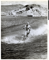
Photograph of Dan Daniels water skiing, Lake Mead, late 1940s
Date
1945 to 1949
Archival Collection
Description
Dan Daniels (who worked for Lake Mead Boat Co.) water skiing on Lake Mead.
Image
Photograph of campers at Lake Mead Recreational Area, 1940s-1950s
Date
1940 to 1959
Archival Collection
Description
Three campers are relaxing at the Lake Mead Recreation Area. One camper is fixing the car and the others are watching.
Image

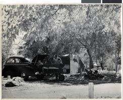
Photograph of Boulder Beach campground at Lake Mead Recreational Area, 1940s-1950s
Date
1940 to 1959
Archival Collection
Description
A car and trailer parked at Lake Mead Recreational Area at the Boulder Beach campground.
Image
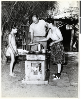
Photograph of a family at Lake Mead campground, 1940s-1950s
Date
1940 to 1959
Archival Collection
Description
A family preparing a meal at the Lake Mead campground. It cost 25 cents to operate the electric meter drop.
Image
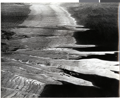
Aerial photograph of Lake Mead, 1940s-1950s
Date
1940 to 1959
Archival Collection
Description
Aerial photo of Lake Mead. Towards the bottom center of the photo, cars and boats can be seen.
Image
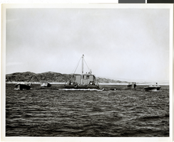
Photograph of boats on Lake Mead, 1940s-1950s
Date
1940 to 1959
Archival Collection
Description
Several different boats on Lake Mead.
Image
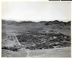
Aerial photograph of Boulder City (Nev.), 1940s-1950s
Date
1940 to 1959
Archival Collection
Description
Aerial view of Boulder City, Nevada.
Image