Search the Special Collections and Archives Portal
Search Results
Human Radiation Experiments Records
Identifier
Abstract
The Human Radiation Experiments Records (1949-1995) contain reports from the National Environmental Policy Act (NEPA), the Advisory Committee on Human Radiation Experiments (ACHRE), and the U. S. Department of Energy (DOE). Also included are newspaper clippings, a court case brought by the National Association of Radiation Survivors (NARS), and cancer research papers. With the goal of building an atomic bomb using plutonium extracted from uranium, the material also examines the outcomes of radiation exposure done on humans during the late 1940s and early 1950s at the Oak Ridge Nuclear Facility in Tennessee.
Archival Collection
UNLV Libraries Collection of Bally Manufacturing and Entertainment Promotional Materials and Reports
Identifier
Abstract
The UNLV Libraries Collection of Bally Manufacturing and Entertainment Promotional Materials and Reports includes annual reports, financial reports, promotional materials, press releases, and clippings dating from 1968 to 2013.
Archival Collection
Young Audiences New York, Nevada Humanities Photograph Collection
Identifier
Abstract
The Young Audiences New York, Nevada Humanities Photograph Collection (approximately 1970-1979) contains black-and-white photographic prints, slides, and negatives of the Las Vegas, Nevada chapter of the Young Audiences New York arts organization. Images include scenes of concerts, workshops, and chapter outings at public parks. There are images of specific bands within the chapter such as the Brass Quintet, Vocal Quartet, and Woodwind Quintet. Lastly, there are images of celebratory banquets honoring members of the Las Vegas chapter.
Archival Collection
Thunderbird Hotel Records
Identifier
Abstract
The Thunderbird Hotel Records are comprised of material that documents the work of the Las Vegas, Nevada hotel's entertainment department from 1964 to 1973. The records consist of photographs, memorandum, newspaper clippings, and publicity materials.
Archival Collection
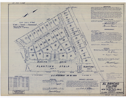
Plat map of El Rancho Village, Clark County, Nevada, July 28, 1942
Date
Description
Text
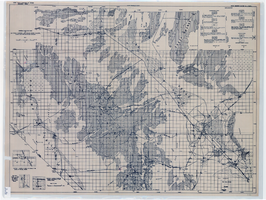
General geologic map of Las Vegas, Pahrump, and Indian Spring Valleys, Clark and Nye Counties, Nevada, 1948
Date
Description
At top of map: 'United States Department of the Interior, Geological Survey. State Engineer of Nevada. Water resources bulletin No. 5, Plate 1.' Relief shown by spot heights. Includes 3 inset maps of wells and springs in the vicinity of Pahrump, Manse Ranch and Indian Springs, Nevada. Scale [ca. 1:126,720. 1 inch to approx. 2 miles] (W 116°--W 115°/N 40°--N 36°). Originally published as plate 1 in Geology and water resources of Las Vegas, Pahrump, and Indian Spring Valleys, Clark and Nye Counties, Nevada by George B. Maxey and C.H. Jameson (1948), which is number 5 of the Water resources bulletin published by the Nevada Office of the State Engineer.
Image
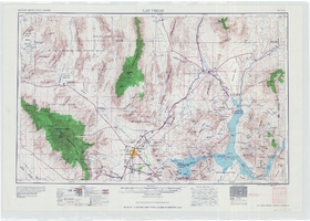
Topographic map of the Las Vegas Valley area, 1959
Date
Description
Image
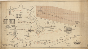
Map showing proposed improvements of Las Vegas Springs, Las Vegas, Nevada, January 26, 1918
Date
Archival Collection
Description
'Exhibit A'. 'Approved Jan. 26, 1918.' Includes discharge figures and plans for improvements to springs for the municipal water system including diagrams of spillway openings, etc. Scale [ca. 1:1200] 1 in.=100 feet -- Scale [ca. 1:120] 1 in.=10 feet -- Scale [ca. 1:240] 1 in.=20 feet -- Scale [ca. 1:24] 1 in.=2 feet -- Scale [ca. 1:2400] 1 in.=200 feet. Vertical scale [ca. 1:48] 1 in.=4 feet -- Scale [ca. 1:12] 1 in.=1 foot.
Image
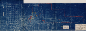
Map to accompany agreement with Willie T. Stewart, Vernon E. Bunker, Earl Leavitt and William Udell Stewart covering lease of Las Vegas Ranch property at Las Vegas, Nevada, January 31, 1951
Date
Archival Collection
Description
Image
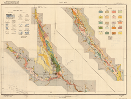
Soil map, Nevada, Moapa Valley sheet, 1923
Date
Archival Collection
Description
Image
