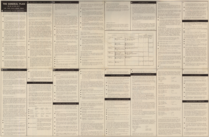
Search Results
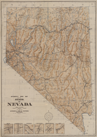
Automobile road map of the state of Nevada, circa 1930
Date
1930
Description
Insets of major roads in Reno, Carson City, Tonopah, Las Vegas, Winnemucca, and Ely at bottom left of map. 'Prepared by the Route and Map Service Department, Automobile Club of Southern California.' 'Copyrighted by the Automobile Club of Southern California.' Scale [ca. 1:1,013,760]. 1 in. to approx. 16 miles. Indexes on map verso.
Text
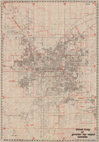
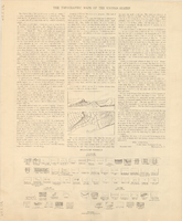
Street map of greater Las Vegas, Nevada, 1984
Date
1984
Description
'The professional street map of greater Las Vegas, Nevada. Detailed guide of Las Vegas, North Las Vegas, Paradise Valley & vicinity' -- front panel. ' Street index on map verso. Original publisher: Front Boy Service Co. Scale [ca. 1:44,352. 1 in. to approx. 0.70 mi.].
Text
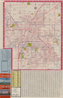


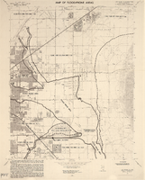
Las Vegas NE quadrangle
Date
1973
Description
'Prepared by the U.S. Department of the Interior, Geological Survey, in cooperation with the U.S. Department of Housing and Urban Development, Federal Insurance Administration. 1973.'
Image
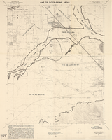
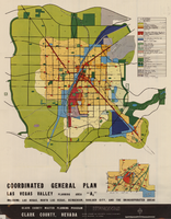
Las Vegas SE quadrangle
Date
1973
Description
'Prepared by the U.S. Department of the Interior, Geological Survey, in cooperation with the U.S. Department of Housing and Urban Development, Federal Insurance Administration. 1973.'
Image