Search Results
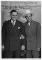
Two unidentified men: photographic print
Date
1880 to 1979
Archival Collection
Description
Dorothy Bell Scans UNLV-Public Lands Institute
Image
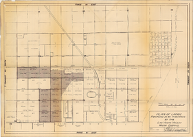
Plan of lands proposed to be purchased by the Las Vegas Valley Water District, August 1, 1952
Date
1952-08-01
Archival Collection
Description
'Date: August 1, 1952. Approved, Thomas A. Campbell, Pres.' Scale: [1 in.=approx. 300 feet]. Library's copy 2 has additional areas shaded, with original shaded areas outlined in red, plus various handwritten notations in pencil.
Image
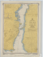
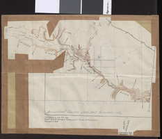
Hydrographic map of Lake Mead, Overton Arm, Southern and Northern Parts, front
Description
Scale: 1:48,000
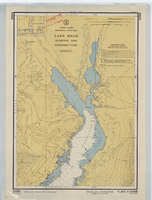
Hydrographic map of Lake Mead, Overton Arm, Southern and Northern Parts, back
Description
Scale: 1:48,000
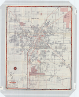
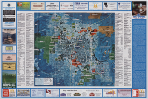
Street map of Las Vegas, 1966
Date
1966
Description
1966 ed. Color; 56 x 43 cm., folded to 23 x 10 cm. Panel title: Street map of Las Vegas and vicinity. On bottom of panel: Humble Oil & Refining Company. Index, photographs of Las Vegas scenes and nearby tourist attractions and map titled Lake Mead National Recreation Area, lower basin section on verso. Original publisher: H. M. Gousha Company.
Image

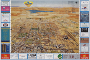
Street map of greater Las Vegas, Nevada, 1965-1966
Date
1965 to 1966
Description
Rev. 1965-1966 ed. 55 x 42 cm., folded to 29 x 12 cm. Panel title: Front Boy's official street map. Relief shown by spot heights. Copyright held by Russell A. Meador. Includes notes, quotations and indexes. Street index on verso. "Detailed guide of North Las Vegas, Las Vegas, Paradise Valley, and vicinity." Original publisher: Meador, Russell A.
Image