Search Results
Photograph of a parade procession for Howard Hughes, New York, July 15, 1938
Date
1938-07-15
Archival Collection
Description
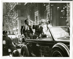
Picture of Grover Whalen, Howard Hughes, and Al Lodwick riding in the back of an automobile during a parade celebrating Howard Hughes' completion of his round-the-world flight.
Image
Photograph of a parade procession for Howard Hughes, New York, July 15, 1938
Date
1938-07-15
Archival Collection
Description
A view of Grover Whalen, Howard Hughes, and Al Lodwick riding in the back of an automobile during a parade celebrating Howard Hughes' completion of his round-the-world flight.
Image
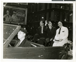
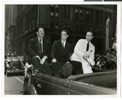
Photograph of a parade procession for Howard Hughes, New York, July 15, 1938
Date
1938-07-15
Archival Collection
Description
Photograph of Grover Whalen, Howard Hughes, and Al Lodwick during a parade procession for the completion of Hughes' Round-the-World flight. Typed onto a piece of paper attached to the image: "Howard Hughes riding up Broadway - waving to throngs. 7/15/38."
Image
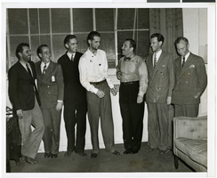
Photograph of Howard Hughes and other men, New York, July 14, 1938
Date
1938-07-14
Archival Collection
Description
Description printed on back of photograph: "At Grover Whalen's home, 48 Washington Mews [sic]. From left to right: L. Thomas Thurlow, Comm. Hl Flannigan, Edward Lund, Howard Hughes, Grover Whalen, R. Stoddart, and Harry Connor. 6/38."
Image
Photograph of a parade procession for Howard Hughes, New York, July 15, 1938
Date
1938-07-15
Archival Collection
Description
Photograph of Grover Whalen, Howard Hughes, and Al Lodwick during a parade procession for the completion of Hughes' Round-the-World flight.
Image
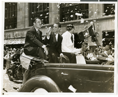
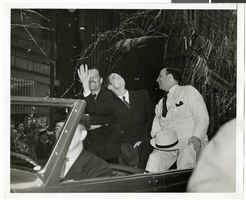
Photograph of a parade procession for Howard Hughes, New York, July 15, 1938
Date
1938-07-15
Archival Collection
Description
Photograph of Grover Whalen, Howard Hughes, and Al Lodwick during a parade procession for the completion of Hughes' Round-the-World flight.
Image
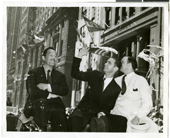
Photograph of a parade procession for Howard Hughes, New York, July 15, 1938
Date
1938-07-15
Archival Collection
Description
A view of Grover Whalen, Howard Hughes, and Al Lodwick riding in the back of an automobile during a parade procession.
Image
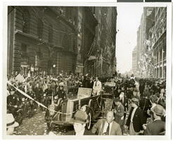
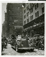
Photograph of a parade procession for Howard Hughes, New York, July 15, 1938
Date
1938-07-15
Archival Collection
Description
A general view of the parade celebrating Howard Hughes' completion of his Round-the-World flight.
Image
Photograph of a parade procession for Howard Hughes, New York, July 15, 1938
Date
1938-07-15
Archival Collection
Description
A view of Grover Whalen, Howard Hughes, and Al Lodwick riding in the back of an automobile during a parade procession.
Image
T-Shirt Color: Navy Blue; Front: In Memory Of Our Fallen Brother PO Stephen Driscoll, City Of New York Police 17482, Police Officer Badge; Back: The Other Twin Towers Of New York, Fire Fighter And Police Officer Standing In Place Of Twin Towers, NYC Burning, approximately 2001-2012
Level of Description
File
Archival Collection
New York-New York Hotel and Casino 9-11 Heroes Tribute Collection
To request this item in person:
Collection Number: MS-00459
Collection Name: New York-New York Hotel and Casino 9-11 Heroes Tribute Collection
Box/Folder: Box 331
Collection Name: New York-New York Hotel and Casino 9-11 Heroes Tribute Collection
Box/Folder: Box 331
Archival Component