Search the Special Collections and Archives Portal
Search Results
Mineral Resources of the United States for calendar year 1910, part 2 Department of the Interior U.S. Geological Survey, 1911
Level of Description
Item
Archival Collection
Raymond Brooks Papers on Mining
To request this item in person:
Collection Number: MS-01153
Collection Name: Raymond Brooks Papers on Mining
Box/Folder: Box 05
Collection Name: Raymond Brooks Papers on Mining
Box/Folder: Box 05
Archival Component
Interstate Commerce Commission Land Valuation, Section 18 - Utah counties, index and Provo Branch U.S.G. dates, 1900s
Level of Description
File
Archival Collection
Union Pacific Railroad Collection
To request this item in person:
Collection Number: MS-00397
Collection Name: Union Pacific Railroad Collection
Box/Folder: Box 144
Collection Name: Union Pacific Railroad Collection
Box/Folder: Box 144
Archival Component
Hazel Denton posed for photograph with two children, Denny and Joan, in front of a house: photographic print, approximately 1900-1965
Level of Description
Item
Archival Collection
Hazel Baker Denton Photograph Collection
To request this item in person:
Collection Number: PH-00312
Collection Name: Hazel Baker Denton Photograph Collection
Box/Folder: Folder 01
Collection Name: Hazel Baker Denton Photograph Collection
Box/Folder: Folder 01
Archival Component
Two-story house surrounded by trees with dirt driveway and pickup truck in front: photographic print, approximately 1900-1965
Level of Description
Item
Archival Collection
Hazel Baker Denton Photograph Collection
To request this item in person:
Collection Number: PH-00312
Collection Name: Hazel Baker Denton Photograph Collection
Box/Folder: Folder 04
Collection Name: Hazel Baker Denton Photograph Collection
Box/Folder: Folder 04
Archival Component

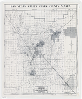
Map of Las Vegas Valley, Clark County, Nevada, 1954
Date
1954
Description
Scale [ca. 1:63,360. 1 in. to approx. 5,280 ft.].Cadastral map. 'Compiled for C.D. Baker, Reg. Civil Engineer Nevada No. 6 and Licensed Real Estate Broker by Tyson Engineering Co., Las Vegas, Nevada.' 'Copyright 1954 Tyson Engineering Co., Las Vegas, Nevada. Drawn by E.M. Ballinger' Tyson Engineering Company
Image
Bundy, McGeorge. Danger and Survival: Choices about the Bomb in the First Fifty Years. New York, NY: Random House, 1977
Level of Description
Item
Archival Collection
Alice P. Broudy Papers on Broudy v. United States
To request this item in person:
Collection Number: MS-00097
Collection Name: Alice P. Broudy Papers on Broudy v. United States
Box/Folder: Box 2
Collection Name: Alice P. Broudy Papers on Broudy v. United States
Box/Folder: Box 2
Archival Component
1818: This Year Thou Shalt Die!!! by the Rev. James Churchill. London: printed by W. Tew for D. Cox, approximately 1818
Level of Description
Item
Archival Collection
Mavis Eggle "Books as They Were Bought" Collection
To request this item in person:
Collection Number: MS-01144
Collection Name: Mavis Eggle "Books as They Were Bought" Collection
Box/Folder: Box 27
Collection Name: Mavis Eggle "Books as They Were Bought" Collection
Box/Folder: Box 27
Archival Component
Miles McWhorter's house in New Lisbon, Wisconsin, with Miles McWhorter, Janet McWhorter, and Delphine Squires, approximately 1860-1900
Level of Description
File
Archival Collection
Charles P. Squires Photograph Collection
To request this item in person:
Collection Number: PH-00002
Collection Name: Charles P. Squires Photograph Collection
Box/Folder: Folder 06
Collection Name: Charles P. Squires Photograph Collection
Box/Folder: Folder 06
Archival Component
Congress Hotel, Dinner by the Chicago Association of Commerce in Honor of the Board of Trade of the City Chicago, menu, approximately 1900 to 1930
Level of Description
File
Archival Collection
UNLV University Libraries Menu Collection
To request this item in person:
Collection Number: MS-00436
Collection Name: UNLV University Libraries Menu Collection
Box/Folder: Box 106
Collection Name: UNLV University Libraries Menu Collection
Box/Folder: Box 106
Archival Component

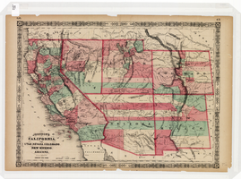
Map of California, Utah, Nevada, Colorado, New Mexico and Arizona, 1864
Date
1864
Description
'Johnson's California, with Utah, Nevada, Colorado, New Mexico, and Arizona, published by Johnson and Ward.' 'Entered according to Act of Congress in the Year 1864 by A.J. Johnson in the Clerks Office of the District Court of the United States for the southern district of New York.' Atlas page numbers in upper margin: 66-67. This is probably plate 67 from Johnson's New Illustrated Family Atlas, published in New York by Johnson & Ward in 1864. Shows natural features, locations of Indian tribes, proposed railroad routes, routes of explorers, trails, county boundaries and populated places ; "." ; Relief shown by hachures ; Prime meridians: Greenwich and Washington ; In top margin: 66-67 ; Hand colored ; On verso: Historical and statistical view of Mexico and central America (p. 79) and Historical and statistical view of the United States, 1860 (p. 78) Scale [ca. 1:3,484,800]. 1 in. to ca. 55 miles (W 124°--W 102°/N 42°--N 32°)
Text
Pagination
Refine my results
Content Type
Creator or Contributor
Subject
Archival Collection
Digital Project
Resource Type
Year
Material Type
Place
Language
Records Classification
