Search Results
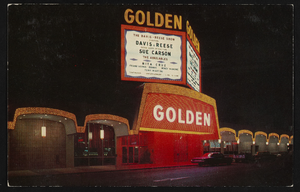
The Golden Hotel in Reno, Nevada: postcard
Date
1940 (year approximate) to 1990 (year approximate)
Archival Collection
Description
From the Harvey's Hotel and Casino Postcard Collection (PH-00367) -- The Golden Hotel in Reno, Nevada. The marquee is advertising Davis Reese, Sue Carson, and Nita Cruz.
Image
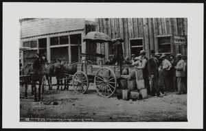
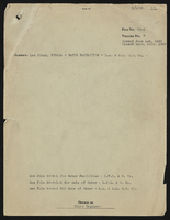
Raiding of a high-grader's cache in Goldfield, Nevada: photographic print
Date
1905 (year approximate) to 1908 (year approximate)
Description
From the Nan Doughty Photograph Collection (PH-00240)
Image
Las Vegas, Nevada - water facilities
Date
1905 to 1927
Archival Collection
Description
Series 6. Chief Engineer and Engineering Files
Mixed Content
Las Vegas, Nevada - water facilities
Date
1905 to 1927
Archival Collection
Description
Series 6. Chief Engineer and Engineering Files
Mixed Content
Las Vegas, Nevada - water facilities
Date
1905 to 1927
Archival Collection
Description
Series 6. Chief Engineer and Engineering Files
Mixed Content
Las Vegas, Nevada - water facilities
Date
1905 to 1927
Archival Collection
Description
Series 6. Chief Engineer and Engineering Files
Mixed Content
Las Vegas, Nevada - water facilities
Date
1905 to 1927
Archival Collection
Description
Series 6. Chief Engineer and Engineering Files
Mixed Content
Las Vegas, Nevada - water facilities
Date
1905 to 1927
Archival Collection
Description
Series 6. Chief Engineer and Engineering Files
Mixed Content
Las Vegas, Nevada - water facilities
Date
1905 to 1927
Archival Collection
Description
Series 6. Chief Engineer and Engineering Files
Mixed Content
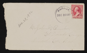
Letter and envelope from Mary Etta Syphus, Panaca, Lincoln Co., Nevada to John M. Bunker, Eldorado Canyon, Nevada
Date
1891-12-28
Archival Collection
Description
From the Syphus-Bunker Papers (MS-00169). The folder contains an original handwritten letter, an envelope, a typed transcription of the same letter, and a copy of original letter attached.
Text