Search Results

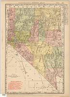
Map showing railroads in Nevada, 1911
Date
1911
Description
Relief shown by hachures. Title below scale: Rand McNally & Co.'s New business atlas map of Nevada. Shows railroads. Includes township and range grid. Includes index to principal cities with population statistics. Includes township and range grid. Index to Nevada counties, lakes, mountains, rivers, towns, etc. on verso. Published by Rand McNally & Co. Scale [ca. 1,710,720]. 1 in. = 27 miles (W 120°--W 114°/N 42°--N 35°). Published as page 321 of Rand-McNally indexed atlas.
Text
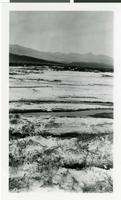
Photograph of the Devil's Golf Course, Death Valley, California, circa 1900s
Date
1900 to 1910
Archival Collection
Description
Views of the salt flats in the Devil's Golf Course part of Death Valley National Park; Handwritten note on back of photo: "Death Valley, Salt Flats, Devils Golf Course".
Image
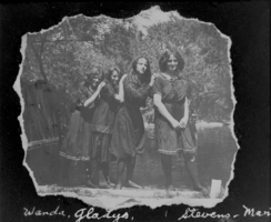
Film transparency of young women in Las Vegas, circa early 1900s
Date
1900 to 1939
Archival Collection
Description
Black and white image of four young women with the following handwritten names underneath: Wanda, Gladys, Stevens, Marie(?). Note: Image is from a family photo album that was loaned to UNLV Libraries Special Collections and returned to the family on July 17, 1984
Image

Film transparency of Wilson's Ranch, Las Vegas, circa early 1900s
Date
1900 to 1939
Archival Collection
Description
Black and white image of a page from an album with a photo of several people gathered around a watering trough at Wilson's Ranch. The photo itself is ripped around the edges. Note: Image is from a family photo album that was loaned to UNLV Libraries Special Collections and returned to the family on July 17, 1984.
Image
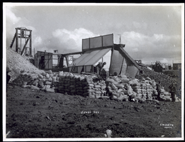
Photograph of workers piling sacks of ore from the Jumbo Mine, Goldfield (Nev.), early 1900s
Archival Collection
Description
Caption: Jumbo Ore
Image
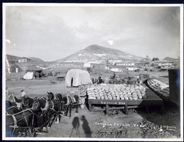
Photograph of ore sacks loading onto Tonopah freight yard, Tonopah (Nev.), early 1900s
Archival Collection
Description
Mizpah mine in the distance on right
Caption: Goldfield Ore. Tonopah Freight Yard.
Caption: Goldfield Ore. Tonopah Freight Yard.
Image