Search Results
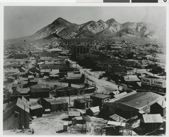
Photograph of Tonopah, Nevada, late 1800s
Date
Archival Collection
Description
Image
An Archeological Element for the Nevada Historic Preservation Plan 1982, Las Vegas, Nevada: Nevada Division of Historic Preservation and Archaeology, 1982
Level of Description
Archival Collection
Archival Component
NDOT (Nevada Department of Transportation) 2000. 2000 Annual Traffic Report. Carson City, Nevada: Nevada Department of Transportation, 2001
Level of Description
Archival Collection
Archival Component
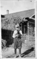
Photograph of Don Schuyler, Sr. and his dog, Las Vegas, Nevada, 1915
Date
Archival Collection
Description
Image
University of Nevada, Las Vegas Faculty Records
Identifier
Abstract
The University of Nevada, Las Vegas (UNLV) Faculty Records (approximately 1956-2006) contain materials related to faculty members at the University of Nevada, Las Vegas. The collection contains summaries of student evaluations, alleged violations by faculty members and disagreements over code changes, course schedule cards, and various faculty group newsletters, bulletins, and handbooks. The collection also contains faculty travel procedures, handbooks, blank forms and instructions, and disbursement documentation.
Archival Collection

Topographic map of groundwater in the southeast quadrangle of Las Vegas, Nevada, 1980
Date
Description
Text
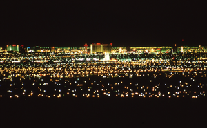
Views of Las Vegas Skyline, Nevada: photographic print
Date
Archival Collection
Description
The city of Las Vegas, NV. Photographs show the city skyline at night while the neon signs are lit and at dusk with the moon over the horizon.
Image
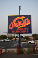
Juicy's Giant Burgers mounted sign, Reno, Nevada
Date
Archival Collection
Description
View of the sign for Juicy's Giant Bugers.
Image

The Lace flag mounted sign, Carson City, Nevada
Date
Archival Collection
Description
View of a sign for The Lace at dusk with unlit neon.
Image
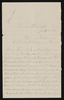
Letter from Mary Etta Syphus, Panaca, Nevada to John M. Bunker, Eldorado Canyon, Nevada
Date
Archival Collection
Description
From the Syphus-Bunker Papers (MS-00169). The folder contains an original handwritten letter, a typed transcription of the same letter, and a copy of original letter attached.
Text