
Search the Special Collections and Archives Portal

Search Results

Display    Results Per Page
Displaying results 1611 - 1620 of 577637

Topographic map of the southeast quadrangle of the metropolitan Las Vegas, Nevada area, 1973

Date

1973

Description

Scale 1:24,000 ; polyconic proj. (W 115°0730--W 115°0000/N 36°0730--N 36°0000) ; 1 map : col. ; 58 x 47 cm ; 7.5 minute series (topographic) ; Relief shown by contours and spot heights ; Filing title: Las Vegas SE, Nev ; "AMS 2956 II SE--Series V896." ; Contour interval 20 feet ; "Topography by photogrammetric methods from aerial photographs taken 1965. Field checked 1967." ; "Revisions shown in purple compiled from aerial photographs taken 1973. This information not field checked." ; Includes quadrangle location map ; Interior--Geological Survey

Image

Topographic map of the southeast quadrangle of the metropolitan Las Vegas, Nevada area, 1967

Date

1967

Description

Scale 1:24,000 ; polyconic proj. (W 115°0730--W 115°0000/N 36°0730--N 36°0000) ; 1 map : col. ; 58 x 47 cm ; 7.5 minute series (topographic) ; Relief shown by contours and spot heights ; Filing title: Las Vegas SE, Nev ; "AMS 2956 II SE--Series V896." ; Contour interval 20 feet ; "Topography by photogrammetric methods from aerial photographs taken 1965. Field checked 1967." ; Includes quadrangle location map ; Interior--Geological Survey

Image

Topographic map of the southwestern quadrangle of the metropolitan Las Vegas, Nevada area, 1973

Date

1973

Description

Scale 1:24,000 ; polyconic proj. (W 115°1500--W 115°0730/N 36°0730--N 36°0000) ; 1 map : col. ; 58 x 47 cm ; 7.5 minute series (topographic) ; Relief shown by contours and spot heights ; Filing title: Las Vegas SW, Nev ; "AMS 2956 II SW--Series V896." ; Contour interval 10 feet ; "Topography by photogrammetric methods from aerial photographs taken 1965. Field checked 1967." ; "Map photoinspected 1973. No major culture or drainage changes observed." ; Includes quadrangle location map ; Interior--Geological Survey

Image

Topographic map of the southwestern quadrangle of the metropolitan Las Vegas, Nevada area, 1967

Date

1967

Description

Scale 1:24,000 ; polyconic proj. (W 115°1500--W 115°0730/N 36°0730--N 36°0000) ; 1 map : col. ; 58 x 47 cm ; 7.5 minute series (topographic) ; Relief shown by contours and spot heights ; Filing title: Las Vegas SW, Nev ; "AMS 2956 II SW--Series V896." ; Contour interval 10 feet ; "Topography by photogrammetric methods from aerial photographs taken 1965. Field checked 1967." ; Includes quadrangle location map ; Interior--Geological Survey

Image

Topographic map of Nevada-California, Las Vegas quadrangle, 1951

Date

1951

Description

'Edition of Mar. 1908, reprinted 1951.' 'E.M. Douglas, geographer in charge; Topography and triangulation by R.H. Chapman, B.D. Stewart, J.E. Blackburn, and D.F.C. Moor. Surveyed in 1906-1907.' Scale 1:250,000 ; polyconic proj. (W 116°00--W 115°00/N 37°00--N 36°00). Relief shown by contours and spot heights. Title in lower-right corner: Nev.-Calif., Las Vegas. Contour interval 100 feet. Datum is mean sea level. U.S. Geological Survey

Image

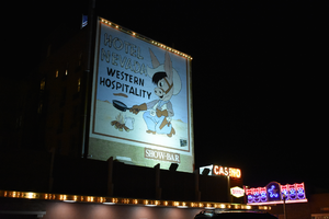
Hotel Nevada billboard, Ely, Nevada

Date

2016 (year approximate) to 2020 (year approximate)

Description

View of the Hotel Nevada billboard reading "Hotel Nevada Western Hospitality."

501 E Aultman St, Ely, NV 89301


Image

Regional Transportation Commission of Southern Nevada: "Las Vegas Resort Corridor Fixed Guideway Downtown Extension (Robert N. Broadbent Las Vegas Monorail Downtown Extension), Section 5309 New Starts Criteria Submittal for Fiscal Year 2006", 2004 August 17

Level of Description

File

Archival Collection

Bruce Turner Collection on Transportation and Water in Southern Nevada
To request this item in person:
Collection Number: MS-00648
Collection Name: Bruce Turner Collection on Transportation and Water in Southern Nevada
Box/Folder: Box 25

Archival Component

Progressive Leadership Alliance of Nevada Records

Identifier

MS-00526

Abstract

The Progressive Leadership Alliance of Nevada (PLAN) records span the years 1994 to 2002 and are comprised of material documenting the organization's involvment in gay issues in Las Vegas, Nevada. PLAN was founded in 1994 as the umbrella organization for Nevada's progressive groups and institutions. This collection is comprised of material documenting the Minority Status and Child Protection Act of 1994 and the Coalition for Unity and Equal Rights Nevada, and contains a number of files from that effort, including opinion surveys, meeting agendas and campaign plans.

Archival Collection

#70510: UNLV Alumna of the Year Kris Engelstad McGarry poses in her Engelstad Family Foundation office October 1, 2015 in Las Vegas., 2015 October 01

Level of Description

File

Archival Collection

University of Nevada, Las Vegas Creative Services Records (2010s)
To request this item in person:
Collection Number: PH-00388-05
Collection Name: University of Nevada, Las Vegas Creative Services Records (2010s)
Box/Folder: Digital File 00

Archival Component

#70396: Danielle Kelly, Executive Director of the Neon Musuem and College of Fine Arts Alumni of the Year award winner on August 17, 2015., 2015 August 17

Level of Description

File

Archival Collection

University of Nevada, Las Vegas Creative Services Records (2010s)
To request this item in person:
Collection Number: PH-00388-05
Collection Name: University of Nevada, Las Vegas Creative Services Records (2010s)
Box/Folder: Digital File 00

Archival Component