Search the Special Collections and Archives Portal
Search Results
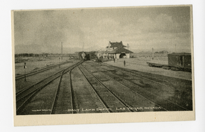
Photograph of the Salt Lake Depot railyard, Las Vegas (Nev.), 1900-1925
Archival Collection
Description
Caption: Salt Lake Depot, Las Vegas, Nevada
Image
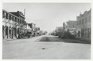
Photograph of Fremont Street, buildings, and automobiles, Las Vegas (Nev.), 1900-1925
Date
Unknown year in the decade of the 1920s
Archival Collection
Description
Fremont Street east of Main Street intersection in early 1920's. Photograph of parked cars and businesses including Bank of Southern Nevada, Las Vegas Hotel, Las Vegas Cafe, and a bakery.
Site Name: Fremont Street (Las Vegas, Nev.)
Site Name: Fremont Street (Las Vegas, Nev.)
Image
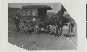
Photograph of horse-drawn ice carriage, Goldfield (Nev.), 1900-1925
Date
1900 to 1925
Archival Collection
Description
Unidentified man stands next to carriage (possibly carrying ice) pulled by two horses. Side of car reads "Goldfield and Columbia Ice."
Image
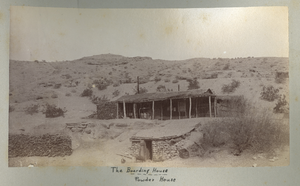
Photograph of the Eldorado Canyon Boarding House, Eldorado Canyon (Nev.), 1900-1925
Date
1900 to 1925
Description
Caption: The Boarding House, Powder House
Image

Photograph of a horse-drawn ore hauler in Eldorado Canyon(Nev.), 1900-1925
Date
1900 to 1925
Description
Caption: In El Dorado Canyon [above] Mill-bound from the Mines [below]
Image
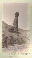
Photograph of a unique rock formation in a canyon, Techatticup Wash (Nev.), 1900-1925
Date
1900 to 1925
Description
Caption: A Formation in the El Dorado or the Techatecup Canyon. (the latter a branch of the former)
Image
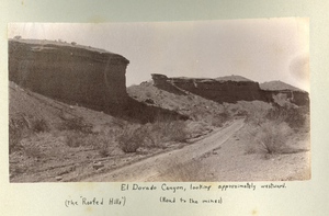
Photograph of Roofed Hills and the road to the mines, Eldorado Canyon (Nev.), 1900-1925
Date
1900 to 1925
Description
Caption: El Dorado Canyon, looking approximately westward. (the Roofed Hills) (Road to the mines)
Image
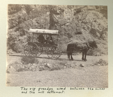
Photograph of a covered wagon on a dirt road, Eldorado Canyon (Nev.), 1900-1925
Date
1900 to 1925
Description
Caption: The rig grandpa used between the mines and the mill settlement.
Image

Map of the Combination Mine, 380 ft., Nye County (Nev.), 1900-1925
Date
1900 to 1925
Description
Sectional mining map; hand-drawn and annotated in colored pencil
Image
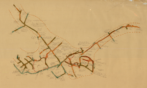
Map of the Combination Mine, 328 ft., Nye County (Nev.), 1900-1925
Date
1900 to 1925
Description
Sectional mining map; hand-drawn and annotated in colored pencil
Image
Pagination
Refine my results
Content Type
Creator or Contributor
Subject
Archival Collection
Digital Project
Resource Type
Year
Material Type
Place
Language
Records Classification
