Search Results
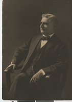
Photograph of a man in a suit, (Nev.), 1900-1940
Date
1900 to 1940
Archival Collection
Description
Unidentified man poses for a photo in a suit and bowtie.
Image
Photographs of the Francis and Neeley families taken throughout Spring Valley, Nevada, 1900 to 1930: digital reproductions
Level of Description
File
Archival Collection
Pearl Francis Neeley Photograph Collection
To request this item in person:
Collection Number: PH-00091
Collection Name: Pearl Francis Neeley Photograph Collection
Box/Folder: Folder 01
Collection Name: Pearl Francis Neeley Photograph Collection
Box/Folder: Folder 01
Archival Component
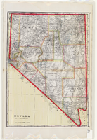
Map of Nevada, circa 1909
Date
1907 to 1911
Description
'Geo. F. Cram, engraver and publisher.' Scale [ca. 1:1,584,000. 1 in. to approx. 25 miles] (W 120°--W 114°/N 42°--N 35°). Relief shown by hachures and spot heights. Counties outlined in color. Shows railroads, forest reserves, mines, Indian reservations, and springs. Shows range and township grid. Indexes on verso to both Nevada and Utah maps. Atlas p. numbers in right margin: 124-125. G.F. Cram.
Text
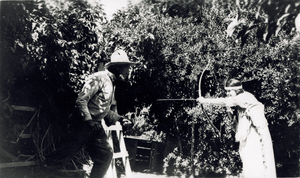
Transparency pf unidentified people, circa 1900-1920
Date
1900 to 1920
Archival Collection
Description
Unidentified people posing at what is possibly the Stewart Ranch in Las Vegas, Nevada.
Image
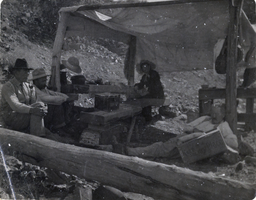
Photograph of men at mining location, circa early 1900s
Date
1900 to 1939
Archival Collection
Description
The view of men under a canvas structure eating at an unidentified mining location, possibly in Nevada.
Image
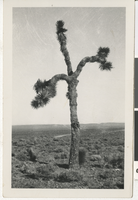
Photograph of a Joshua tree, Goldfield (Nev.), 1900-1920
Date
1900 to 1920
Archival Collection
Description
Joshua trees, Nevada. "Mother's price picture. Goldfield, Nevada." " Emlarged by Earl V Lewis. Photographic Co. Los Angeles"
Image
Field note books, diaries, archaeological inventory and survey records, 1925-1983
Level of Description
File
Archival Collection
Frank D. Rathbun Archaeology Papers
To request this item in person:
Collection Number: MS-00209
Collection Name: Frank D. Rathbun Archaeology Papers
Box/Folder: Box 04 (Restrictions apply)
Collection Name: Frank D. Rathbun Archaeology Papers
Box/Folder: Box 04 (Restrictions apply)
Archival Component

Photograph of an Indian handgame, Owyhee, (Nev.), early 1900s
Date
1900 to 1920
Archival Collection
Description
Transcribed from photograph, "Indian bone game, July 4, Owyhee, Nevada. Shoshone - 9. Indian handgames at the 4th of July encampment at Owyhee, Nevada. The handgames are common to all Nevada tribes and are played at social events. Inter-tribal Council of Nevada. Courtesy of Agnes Tybo."
Image
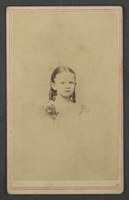
Photograph of unknown girl, circa 1800-1900
Date
1800 to 1900
Archival Collection
Description
A portrait of an unknown girl probably a Clifton or Stocker relative.
Image
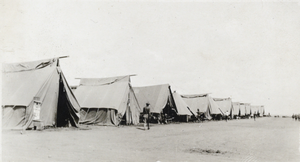
Photograph of a line of tents, circa early 1900s
Date
1900 to 1949
Archival Collection
Description
Description given with photograph: "Tents of the 87th Squadron (one of 125)."
Image