Search Results
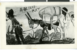
Photograph of a cartoon titled "A Desert Rat," circa early 1900s
Date
1900 to 1930
Archival Collection
Description
Cartoon of a prospector, donkey, and a native American woman with the title, "A Desert Rat."
Image
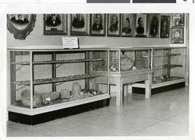
Photograph of Rockwell Indian Arrow Exhibit, circa early 1900s
Date
1900 to 1970
Archival Collection
Description
Rockwell Indian artifacts in museum.
Image

Photograph of Rockwell Indian Basket Exhibit, circa early 1900s
Date
1900 to 1970
Archival Collection
Description
Rockwell Indian Basket Exhibit.
Image
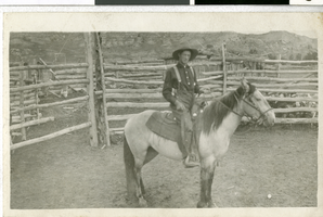
Postcard of Sandstone Ranch in Redrock Canyon, circa early 1900s
Date
1900 to 1939
Archival Collection
Description
An unidentified man on a horse at Sandstone Ranch.
Image
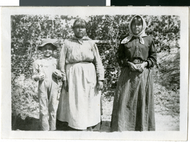
Photograph of women and a boy, unknown location, circa early 1900s
Date
1900 to 1929
Archival Collection
Description
Photograph of two unidentified Paiute women and a boy.
Image
Photograph of log cabins in Panguitch, Utah, circa early 1900s
Date
1900 to 1940
Archival Collection
Description
An exterior view of log cabins in Panguitch.
Image
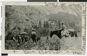
Photograph of people in a Yosemite park area, circa ealry 1900s
Date
1900 to 1910
Archival Collection
Description
Description given with photograph: "Selig moving picture outfit making 'The Rescue of Daniel Boone's Daughter'". "Yosemite - Dan Boone, Maj. Forsythes daughter, sup. Of Park"
Image

Photograph of Clarence Fry, Oswego, Kansas, circa early 1900s
Date
1900 to 1920
Archival Collection
Description
Portrait of Clarence Fry in Oswego, Kansas.
Image
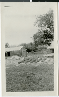
Photograph of old fort, Las Vegas (Nev.), early 1900s
Date
1900 to 1910
Archival Collection
Description
Old Ranch. Original description: "The Old fort where the white men used to defend themselves from the Indians. The wall extending to the left is crumbling away. Those are fig trees overhanging the wall."
Image
Photograph of old fort, Las Vegas (Nev.), early 1900s
Date
1900 to 1910
Archival Collection
Description
Old Ranch. Written on the back: "I don't know what this is but it must have been somewhere on the ranch." M. Copeland. "After writing the above I discovered this building in the Las Vegas book. It apparently is the fort from another side." (pg. 45)
Image