Search Results

Aid for AIDS of Nevada 2002 AIDS Walk registration form
Date
2002-04-28
Archival Collection
Description
From the Dennis McBride Collection on LGBTQ Las Vegas, Nevada (MS-00802) -- Alphabetical research files -- AIDS: Organizations: Aid for AIDS of Nevada (AFAN) file.
Text
Aid for AIDS of Nevada 1998 AIDS Walk press release
Date
1998-01-05
Archival Collection
Description
From the Dennis McBride Collection on LGBTQ Las Vegas, Nevada (MS-00802) -- Alphabetical research files -- AIDS: Organizations: Aid for AIDS of Nevada (AFAN) file.
Text
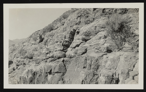
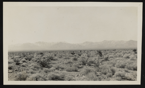
Bacon dolomite, Nevada: photographic print
Date
1910 (year approximate) to 1930 (year approximate)
Archival Collection
Description
From the Chester R. Longwell Photograph Collection (PH-00311). "Bacon" dolomite in M.P, north of Cane Spring Road. N i-30.
Image
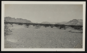
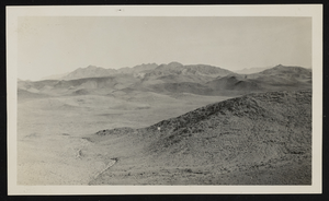
View of a mountain in Nevada: photographic print
Date
1910 (year approximate) to 1930 (year approximate)
Archival Collection
Description
From the Chester R. Longwell Photograph Collection (PH-00311). Area between Sawtooth Ridge and St. Thomas from the west.
Image
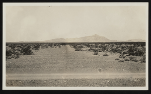
View of a road in Nevada: photographic print
Date
1910 (year approximate) to 1930 (year approximate)
Archival Collection
Description
From the Chester R. Longwell Photograph Collection (PH-00311). The road lies between Searchlight and Gabbs.
Image
View of landscape in Nevada: photographic print
Date
1910 (year approximate) to 1930 (year approximate)
Archival Collection
Description
From the Chester R. Longwell Photograph Collection (PH-00311). Toward Mount Sterling from highway west of Indian Inn. NV-38.
Image
Volcanic Hills, Nevada: photographic print
Date
1910 (year approximate) to 1930 (year approximate)
Archival Collection
Description
From the Chester R. Longwell Photograph Collection (PH-00311). North of Frenchman Flat. N IV-93.
Image
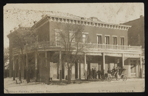
Brown Hotel in Eureka, Nevada: postcard
Date
1860 (year approximate) to 1959 (year approximate)
Archival Collection
Description
From the Albert S. Henderson Photograph Collection (PH-00317).
Image
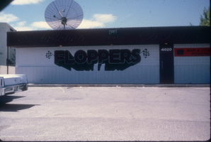
Slide of Flopper's Bar, Nevada, 1986
Date
1986
Archival Collection
Description
Flopper's Bar located on the side of the Nevada Highway in Nevada. Site Name: Flopper's Bar (Las Vegas, Nev.)
Image

Map of Las Vegas Valley artesian basin, circa 1940
Date
1938 to 1942
Description
Scale [ca. 1:72,000. 1 in.=approx. 6,000 feet] (W 115°10´--W 115°/N 36°20´--N 36´). Shows wells, springs, boundary between valley fill and bedrock, and ground water district boundaries for Las Vegas Metropolitan Area and North Las Vegas. "Figure 1." Nevada. State Engineer
Image