Search Results
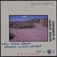
Photographic slide of Wall Creek Ranch, Nevada, August 2, 1963
Date
Archival Collection
Description
Image
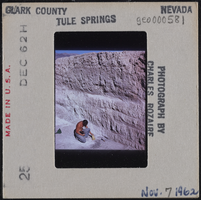
Photographic slide of a man at Tule Springs, Nevada, November 7, 1962
Date
Archival Collection
Description
Image
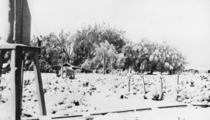
Old ranch house on the Carver ranch, Nevada: photographic print
Date
Archival Collection
Description
From the Nye County, Nevada Photograph Collection (PH-00221) -- Series V. Smoky Valley, Nevada and Round Mountain, Nevada -- Subseries V.A. Carver, Carver-Duhme, and Carver-Book Families (Smoky Valley). The water tank, which was filled by artesian water flow using a hydraulic ram, is on the right side.
Image
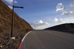
Cloudrock Court in the Ascaya development, Henderson, Nevada: digital photograph
Date
Archival Collection
Description
Image
Cloudrock Court in the Ascaya development, Henderson, Nevada: digital photograph
Date
Archival Collection
Description
Image

People posing on Mount Charleston, Nevada: photographic print
Date
Archival Collection
Description
Image
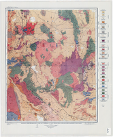
Geologic reconnaissance map of portions of southwestern Nevada and eastern California, 1905
Date
Description
Image
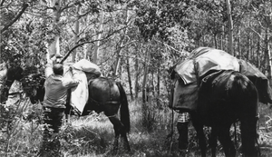
Unloading the pack horses, Wardenot pasture, Nevada: photographic print
Date
Archival Collection
Description
From the Nye County, Nevada Photograph Collection (PH-00221) -- Series V. Smoky Valley, Nevada and Round Mountain, Nevada -- Subseries V.A. Carver, Carver-Duhme, and Carver-Book Families (Smoky Valley). Gerald Miller Carver and Gary Carver is partially visible (identified from left to right).
Image
Old ranch house on the Carver ranch, Nevada: photographic print
Date
Archival Collection
Description
From the Nye County, Nevada Photograph Collection (PH-00221) -- Series V. Smoky Valley, Nevada and Round Mountain, Nevada -- Subseries V.A. Carver, Carver-Duhme, and Carver-Book Families (Smoky Valley). The water tank, which was filled by artesian water flow using a hydraulic ram, is on the right side.
Image
Cloudrock Court in the Ascaya development, Henderson, Nevada: digital photograph
Date
Archival Collection
Description
Image