Search Results
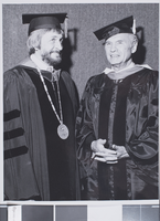
Photograph of commencement for the University of Nevada, Las Vegas, 1977
Date
Archival Collection
Description
Donald Baepler (left) and Hank Greenspun (right) at a commencement ceremony for the University of Nevada, Las Vegas (UNLV).
Image
James W. Hulse Manuscript of Lincoln County, Nevada
Identifier
Abstract
The James W. Hulse collection (1973) consists of the original manuscript for his book on the history of Lincoln County, Nevada.
Archival Collection
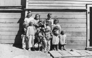
Students in front of a school at Tybo, Nevada: photographic print
Date
Archival Collection
Description
From the Nye County, Nevada Photograph Collection (PH-00221) -- Series VII. Other areas in Nye County -- Subseries VII.C. Fallini Family (Twin Springs, Nevada). Anna Baird Green, sister of Helen Baird Fallini, is in the back row, far left.
Image

Video, "Probe" episode on American Nevada Corporation, 1987
Date
Archival Collection
Description
Episode of Probe featuring Mark Fine discussing the development of the Green Valley area of Henderson, Nevada.
Moving Image
Charles Rozaire Collection on Tule Springs, Nevada
Identifier
Abstract
The Charles Rozaire Collection on Tule Springs, Nevada (1950-2005) contains photographic slides of various archeological sites across Clark County, Nevada, the majority of which were taken at the Tule Springs archaeological site. The collection also contains Rozaire's files documenting the excavation investigations at Tule Springs which include Rozaire's writings, newspaper clippings, programs, and photocopied articles regarding Tule Springs.
Archival Collection
Books and Pamphlets: Bureau of Land Management publications regarding federal funding, land use, Nevada progress reports, BLM in Nevada, and Nevada wilderness management, 1980-1981
Level of Description
Archival Collection
Collection Name: Jane Ham Legislative Papers
Box/Folder: Box 01
Archival Component
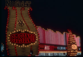
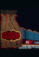
Slide of the Nugget Casino, Carson City, Nevada, circa 1980s
Date
Archival Collection
Description
Image
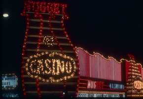
Slide of the Nugget Casino, Carson City, Nevada, circa 1980s
Date
Archival Collection
Description
Image

Slide of the Nugget Casino, Carson City, Nevada, circa 1980s
Date
Archival Collection
Description
Image
Slide of the Nugget Casino, Carson City, Nevada, circa 1980s
Date
Archival Collection
Description
Image