Search Results

University of Nevada, Las Vegas (UNLV) 43rd commencement program
Date
Archival Collection
Description
Commencement program from University of Nevada, Las Vegas Commencement Programs and Graduation Lists (UA-00115).
Text
University of Nevada, Las Vegas Alumni Association Sports Memorabilia Collection
Identifier
Abstract
The University of Nevada, Las Vegas Alumni Association of Sports Memorabilia collection is comprised of the University of Nevada, Las Vegas (UNLV) sports memorabilia collected by the UNLV Alumni Association from the 1970s to 1997. The collection primarily includes memorabilia relating to UNLV basketball during the late 1980s and the early 1990s.
Archival Collection
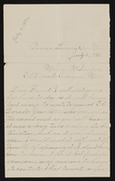
Letter from Mary Etta Syphus, Panaca, Nevada to John M. Bunker, Eldorado Canyon, Nevada
Date
Archival Collection
Description
From the Syphus-Bunker Papers (MS-00169). The folder contains an original handwritten letter, a typed transcription of the same letter, and a copy of original letter attached.
Text
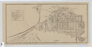
Cadastral map of Boulder City, Nevada, 1940
Date
Description
A. M. S. Jan. 1940 in the lower left-hand corner. 1 map ; 61 x 30 cm. Cadastral map. "No. 40-1" in the lower right-hand corner. Shows block and lot numbers, buildings, water supply and sewage system, leased areas.
Image

Topographic map of groundwater in the southeast quadrangle of Las Vegas, Nevada, 1980
Date
Description
Text
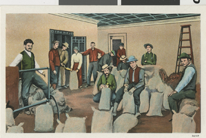
Goldfield, Nevada, twelve men: postcard
Date
Archival Collection
Description
Image
Southern Nevada Jewish Heritage Project Community Collection
Identifier
Abstract
The Southern Nevada Jewish Heritage Project Community Collection is comprised of organizational records, photographs, event programs, and ephemera donated by members of the Southern Nevada Jewish community as part of the University of Nevada, Las Vegas University Libraries’ Southern Nevada Jewish Heritage Project. Materials document the history of the Jewish community and Southern Nevada from 1941 to 2017. The collection provides information about family life, religious rituals, community events, and local businesses and organizations.
Archival Collection
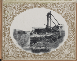
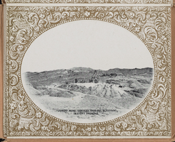
"Souvenir of Tonopah, Nevada" with photos from Goldfield, Tonopah, and Searchlight, Nevada: photograph album, image 028
Description
"Souvenir of Tonopah, Nevada" with photos from Goldfield, Tonopah, and Searchlight, Nevada: photograph album, image 030
Description
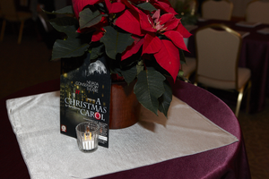
UNLV President Neal Smatresk hosts a pre-performance reception for the Nevada Conservatory Theatre's production of "A Christmas Carol" December 9, 2011 at the University of Nevada, Las Vegas: digital photographs
Date
Archival Collection
Description
Image