Search Results
50 Years of Residence Hall Leadership by Jon K. Coleman, HRL staff group photograph at Hoover Dam, photographic negatives, approximately 1995 to 2014
Level of Description
Archival Collection
Collection Name: University of Nevada, Las Vegas Housing and Residential Life Records
Box/Folder: Box 07
Archival Component
Charles S. Sprague and Benjamin Gill Papers on Nevada Mining
Identifier
Abstract
The Charles S. Sprague and Benjamin Gill Papers on Nevada Mining (1904-1925) are comprised of various records from the mining companies owned and operated by businessmen Charles S. Sprague and Benjamin Gill who were active in the central Nevada boomtowns of Goldfield and Tonopah in the early twentieth century. Documents include correspondence, receipts and invoices, detailed records and copies of government legislative bills relating to the mining industry, and other business correspondence. Sprague's collection consists of his mining business correspondence dating from 1906 to 1925. Gill's papers are comprised of his business correspondence from 1916 to 1922.
Archival Collection

Map of Las Vegas and vicinity, Clark County, Nevada, November 1952
Date
Description
Image
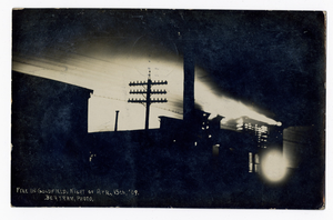
Fire in Goldfield, Nevada: postcard
Description
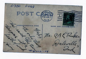
Fire in Goldfield, Nevada: postcard
Description

Bank of Nevada located in Las Vegas, Nevada: photographic print
Date
Archival Collection
Description
Image

Surficial geologic map of the Specter Range NW quadrangle, Nye County, Nevada, 1989
Date
Description
Image

Map showing second stage plan of development for Southern Nevada Water Project, March 1981
Date
Description
Image
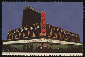
Club Cal Nevada in Reno, Nevada: postcard
Date
Archival Collection
Description
Image
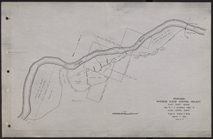
Map of proposed flood control project on the Virgin River in Clark County, Nevada, March, 1934
Date
Archival Collection
Description
Image