Search Results
Annotated Bibliography for Biologic Overview for the Nevada Nuclear Waste Storage Investigations - Nevada Test Site, Nye County, Nevada, 1981 December
Level of Description
Archival Collection
Collection Name: Yucca Mountain Site Characterization Office Collection
Box/Folder: Box 46
Archival Component
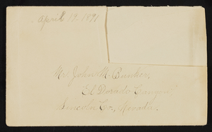
Letter and envelope from Mary Etta Syphus, Panaca, Nevada to John M. Bunker, Eldorado Canyon, Nevada
Date
Archival Collection
Description
From the Syphus-Bunker Papers (MS-00169). The folder contains an original handwritten letter, a typed transcription of the same letter, the original envelope with the stamp removed, and a copy of the original letter.
Text
Nancy Wier Papers on Rock Art in Southern Nevada
Identifier
Abstract
The Nancy Wier Papers on Rock Art in Southern Nevada (approximately 1930-2003) contain photographs, notes, research, and publications focused on rock art (rock writing) found in the Southern Nevada Region. Wier founded the Southern Nevada Rock Art Enthusiasts (SNRAE) in 1992, and the photograph albums document trips across Nevada, Southern California, Utah, and Arizona. The photograph albums are grouped by site location, and the description was taken directly from Wier's albums. The majority of the collection documents rock writings in Southern Nevada.
Archival Collection
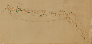
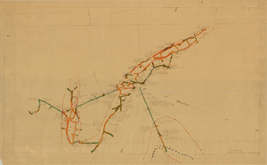
Map of the second level of the Red Top Mine, Goldfield, Nevada, circa 1902-1908
Date
Description
Image
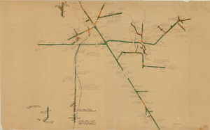
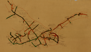
Map of the 380 foot level of the Combination Mine, Goldfield, Nevada, circa 1902-1908
Date
Description
Image
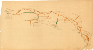
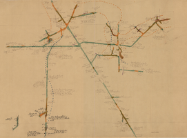
Map of the third level of the Red Top Mine, Goldfield, Nevada, circa 1902-1908
Date
Description
Image

Map of the 328 foot level of the Combination Mine, Goldfield, Nevada, circa 1902-1908
Date
Description
Image
Map of the 130 foot level of the Combination Mine, Goldfield, Nevada, circa 1902-1908
Date
Description
Image
Map of the 330 foot level of the Combination Mine, Goldfield, Nevada, circa 1902-1908
Date
Description
Image
Map of the 380 foot level of the Locke Mine, Goldfield, Nevada, circa 1902-1908
Date
Description
Image