Search Results
NDOT (Nevada Department of Transportation) 2000. 2000 Annual Traffic Report. Carson City, Nevada: Nevada Department of Transportation, 2001
Level of Description
Archival Collection
Collection Name: Environmental Radiation Protection Standards for Yucca Mountain, Nevada
Box/Folder: Box 41
Archival Component
State of Nevada Department of Highways - 1961-1962 / Nevada, Nevada Department of Highways/Rand McNally & Co., 1961 to 1962
Level of Description
Archival Collection
Collection Name: UNLV University Libraries Collection of Maps
Box/Folder: Flat File 048
Archival Component
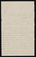
Letter from Mary Etta Syphus, Panaca, Nevada to John M. Bunker, Eldorado Canyon, Nevada
Date
Archival Collection
Description
From the Syphus-Bunker Papers (MS-00169). The folder contains an original handwritten letter, a typed transcription of the same letter, and a copy of original letter attached.
Text
Panaca, Nevada, 1890-1972
Level of Description
Scope and Contents
Materials include photographs of Panaca, Nevada from 1890 to 1972, including photographs of Panaca's schools, buildings, Elbert Edwards's family home, geographic features near the town, and people working.
Archival Collection
Collection Name: Elbert Edwards Photograph Collection
Box/Folder: N/A
Archival Component

Topographic map of groundwater in the southeast quadrangle of Las Vegas, Nevada, 1980
Date
Description
Text
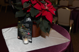
UNLV President Neal Smatresk hosts a pre-performance reception for the Nevada Conservatory Theatre's production of "A Christmas Carol" December 9, 2011 at the University of Nevada, Las Vegas: digital photographs
Date
Archival Collection
Description
Image
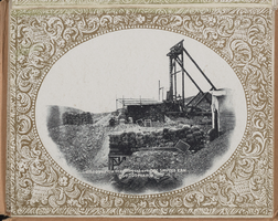
"Souvenir of Tonopah, Nevada" with photos from Goldfield, Tonopah, and Searchlight, Nevada: photograph album, image 028
Description
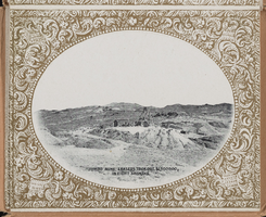
"Souvenir of Tonopah, Nevada" with photos from Goldfield, Tonopah, and Searchlight, Nevada: photograph album, image 030
Description
University of Nevada, Las Vegas Department of Health and Physical Education Records
Identifier
Abstract
The University of Nevada, Las Vegas Department of Health and Physical Education Records (1957-1997) is comprised of University of Nevada, Las Vegas records primarily dealing with the reorganization of departments from 1994-1997. Materials include national studies, internal memos, newspaper articles, public correspondences, and histories of the university, relevant departments, and professors.
Archival Collection
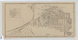
Cadastral map of Boulder City, Nevada, 1940
Date
Description
A. M. S. Jan. 1940 in the lower left-hand corner. 1 map ; 61 x 30 cm. Cadastral map. "No. 40-1" in the lower right-hand corner. Shows block and lot numbers, buildings, water supply and sewage system, leased areas.
Image