Search Results
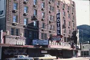
Slide of Nevada Club, Ely, Nevada, 1986
Date
Archival Collection
Description
Image
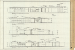
Architectural drawing of the Rugar residence, Las Vegas, Nevada, exterior elevations, December 31, 1962
Date
Archival Collection
Description
Drawings of exterior elevations A, B, C and D for the Rugar residence, Las Vegas, Nevada. "Sheet no. 8 of 20." "James Brooks McDaniel, A.I.A., Architect." "Job no. R62-1." "Drawn by J.M. Checked by J.Mc." "Scale: 1/4" = 1'-0"."
Site Name: Rugar residence
Image

Geologic map and sections of area along Colorado River between Lake Mead and Davis Dam, Arizona and Nevada, 1963
Date
Description
374-E. Originally published as plate 1 in: Reconnaissance geology between Lake Mead and Davis Dam, Arizona-Nevada / by Chester R. Longwell, published by the U.S. Government Printing Office in 1963 in the series Shorter contributions to general geology and as Geological Survey professional paper 374-E.
Image
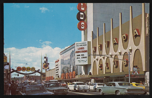
The Nevada Club in Reno, Nevada: postcard
Date
Archival Collection
Description
Image
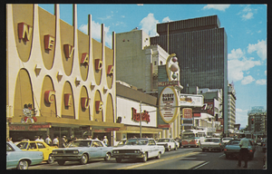
The Nevada Club in Reno, Nevada: postcard
Date
Archival Collection
Description
Image
Equal Rights Nevada Collection
Identifier
Abstract
The Equal Rights Nevada (2000-2002) collection is comprised of organizational records documenting the group’s unsuccessful fight against Question 2, a referendum voted upon in 2000 and 2002 to amend Nevada’s state constitution to forbid same-sex marriage. It includes campaign files, financial records, publicity, correspondence, ephemera, and other supporting documentation from national and regional marriage equality organizations.
Archival Collection

Map showing parts of eastern and southeastern Nevada and southwestern Utah, circa 1873
Date
Archival Collection
Description
Image

The Nevada Club in Reno, Nevada: postcard
Date
Archival Collection
Description
Image

Map of Boulder Dam area and Las Vegas, Nevada, October 7, 1930
Date
Description
Text
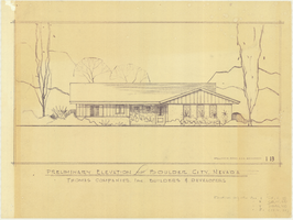
Architectural drawing of residential home in Boulder City, Nevada, preliminary elevation, 1962
Date
Archival Collection
Description
Preliminary drawing of front exterior elevation of ra anch-style residential home in Boulder City, Nevada. Handwritten near lower right: "Elevations only for Plan 1 (1B, 1C, 1D), Plan 2 (2B, 2C, 2D), Plan 4 (4B, 4C, 4D), Plan 5 (5B, 5C, 5D)."
Architecture Period: Mid-Century ModernistImage