Search Results
Digital image of Nevada Test Site protestors, circa 1980-1999
Date
1980 to 1999
Archival Collection
Description
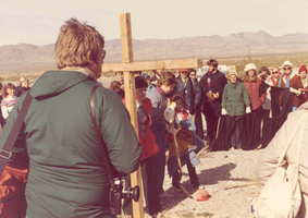
Protestors standing around a wooden cross at the Nevada Test Site.
Image

Digital image of Nevada Test Site protestors, circa 1980-1999
Date
1980 to 1999
Archival Collection
Description
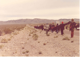
Protest standing along the side of a road at the Nevada Test Site.
Image

Digital image of Nevada Test Site protestors, circa 1980-1999
Date
1980 to 1999
Archival Collection
Description
Protestors walking along side a road at the Nevada Test Site.
Image
Digital image of Nevada Test Site protestors, circa 1980-1999
Date
1980 to 1999
Archival Collection
Description
Protestors walking along side a road at the Nevada Test Site.
Image

Digital image of Nevada Test Site protestors, circa 1980-1999
Date
1980 to 1999
Archival Collection
Description
Protestors walking along side a road at the Nevada Test Site.
Image

Digital image of Nevada Test Site protestors, circa 1980-1999
Date
1980 to 1999
Archival Collection
Description
Protestors walking along side a road at the Nevada Test Site.
Image
Photograph of Ida Browder Kelley, Boulder City, Nevada, circa 1981
Date
1981
Archival Collection
Description
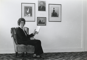
Ida Browder Kelley posing in Elton Garrett's history room located in Boulder City, Nevada. The photos on the wall are of Mrs. Kelley's mother also in Boulder City, Nevada.
Image
Hydrology and Water Resources Overview for the Nevada Nuclear Waste Storage Investigations, Nevada Test Site, New County, Nevada - Los Alamos National Laboratory, Los Alamos, New Mexico, 1981 June
Level of Description
File
Archival Collection
Yucca Mountain Site Characterization Office Collection
To request this item in person:
Collection Number: MS-00091
Collection Name: Yucca Mountain Site Characterization Office Collection
Box/Folder: Box 59
Collection Name: Yucca Mountain Site Characterization Office Collection
Box/Folder: Box 59
Archival Component
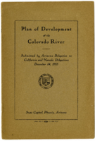
Proposal submitted to the delegates representing the States of California and Nevada in reference to the development of the Colorado River
Date
1925
Description
Proposal submitted to the delegates representing the States of California and Nevada in reference to the development of the Colorado River
Text

Meeting minutes for Consolidated Student Senate, University of Nevada, Las Vegas, July 17, 1979
Date
1979-07-17
Archival Collection
Description
Agenda and meeting minutes for the University of Nevada, Las Vegas Student Senate. CSUN Session 8 Meeting Minutes and Agendas.
Text