Search Results
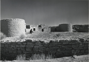
Photograph of Nevada's Lost City, circa 1930s-1940s
Date
Archival Collection
Description
Image
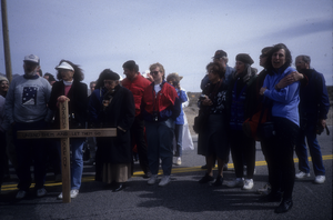
Slide of protesters at a demonstration near the Nevada Test Site, March 8, 1991
Date
Archival Collection
Description
Image
UNLV University Libraries Photographs of the Development of the Las Vegas Valley, Nevada
Identifier
Abstract
The UNLV University Libraries Photographs of the Development of the Las Vegas Valley, Nevada (2016-2020) are comprised of digital photographs captured as part of the Special Collections and Archives Building Las Vegas project. Digital photographs shot in the Las Vegas Valley, Nevada, include color images of street scenes, neighborhoods, developments, land use, housing, flood control, parks, traffic patterns, and parts of the tourism corridor including casinos and hotels.
Archival Collection
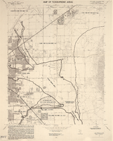
Maps of flood-prone areas in Las Vegas, Nevada, 1973
Date
Description
Image
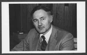
Photograph of Robert Bersi, Las Vegas, Nevada, 1984
Date
Archival Collection
Description
Image
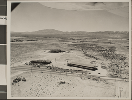
Slide of the University of Nevada, Las Vegas, circa 1959
Date
Archival Collection
Description
Image
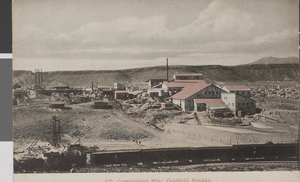
Postcard of the Combination Mine, Goldfield, Nevada, circa 1900s
Date
Archival Collection
Description
Image
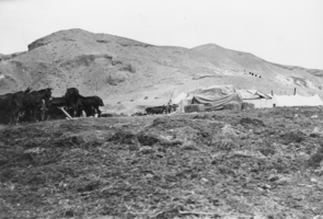
Horses at the Resting Spring Ranch, Nevada: photographic print
Date
Archival Collection
Description
From the Nye County, Nevada Photograph Collection (PH-00221) -- Series IV. Pahrump, Nevada -- Subseries IV.G. Brown Family (Tecopa-Pahrump)
Image
Home Means Nevada: Folklife in the Silver State oral history interviews
Identifier
Abstract
The interviews in this original radio series were produced by the Folk Arts Program of the Nevada Arts Council (then Nevada State Council on the Arts) in 1986, in partnership with KUNR (Reno), KNPR (Las Vegas) and KOLO (Reno), and with funding from the National Endowment for the Arts and the State of Nevada. Scripting, editing, photography, and production were by folklorist Blanton Owen. Narration was by Deb Spring, KOLO Radio (Reno). The series consists of thirteen short segments documenting aspects of the traditional life and crafts of Nevada residents. A supplemental printed program provides additional information about each interviewee.
Archival Collection
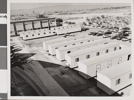
Photograph of Nevada Southern University, circa 1960s-1970s
Date
Archival Collection
Description
The Laboratory and Faculty trailers at Nevada Southern University.
Image