Search Results

Slide of the neon sign for the Driftwood Lounge, Nevada, 1986
Date
1986
Archival Collection
Description
A color image of the neon sign for the Driftwood Lounge, lit up at night. The sign features a neon cocktail glass. The lounge was possibly located in Sparks, Nevada. Site Name: Driftwood Lounge (Washoe County, Nev.)
Image
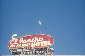
Slide of El Rancho Hotel, Wells, Nevada, 1986
Date
1986
Archival Collection
Description
An image of the neon sign for the El Rancho Hotel located in Wells, Nevada. The red and white sign reads: "El Rancho Hotel; Cafe, Bar, Casino." Site Name: El Rancho Hotel (Wells, Nev.)
Image
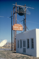
Slide of the Hyde Drive Inn, Wells, Nevada, 1986
Date
1986
Archival Collection
Description
An image of the Hyde Drive Inn located in Wells, Nevada. The orange and white neon sign beside the building reads: "Hyde Drive Inn; Trailer Parking." Site Name: Hyde Drive Inn (Wells, Nev.)
Image
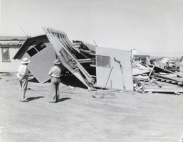
Photograph of tornado damage in Midway City, Nevada, 1931
Date
1931
Archival Collection
Description
A view of tornado damage done in Midway City, Nevada. This damage site was located eight miles out of the Hoover Dam highway in Nevada.
Image
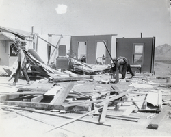
Photograph of tornado damage in Midway City, Nevada, 1931
Date
1931
Archival Collection
Description
A view of tornado damage done in Midway City, Nevada. This damage site was located eight miles out of the Hoover Dam highway in Nevada.
Image
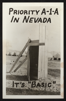
Postcard of outhouse and tents, Henderson, Nevada, circa 1941
Date
1941 (year approximate)
Archival Collection
Description
Postcard of outhouse and tent buildings, probably at Basic Magnesium site, Henderson, Nevada. "Priority A-1-A in Nevada, It's 'Basic'" written on front of card.
Image
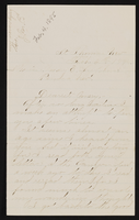
Letter (envelope missing) from John M. Bunker, St. Thomas, Nevada to Mary Etta Syphus, Panaca, Nevada
Date
1895-02-04
Archival Collection
Description
From the Syphus-Bunker Papers (MS-00169). The folder contains an original handwritten letter, a typed transcription of the same letter, and a copy of original letter attached.
Text
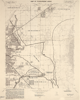
Maps of flood-prone areas in Las Vegas, Nevada, 1973
Date
1973
Description
'Prepared by the U.S. Department of the Interior, Geological Survey, in cooperation with the U.S. Department of Housing and Urban Development, Federal Insurance Administration. 1973.' Sheet 1: Las Vegas NE, Nev.; Sheet 2: Las Vegas SE, Nev.; Sheet 3:Las Vegas SW, Nev.; Sheet 4: Las Vegas NW, Nev. Published by Geological Survey (U.S.). Scale 1:24,000. [1 in. to approx. 2,000 ft.]. Relief shown by contours. Flood information overprinted on U.S. Geological Survey 7.5 minute topographic quadrangles: [sheet 1] Las Vegas NE quadrangle, [sheet 2] Las Vegas SE quadrangle, [sheet 3] Las Vegas SW quadrangle, [sheet 4] Las Vegas NW quadrangle, 1967. Shows areas subject to flooding by a flood that has 1 in 100 chance on the average of occurring in any one year. "Flood boundaries were estimated from: regional stage-frequency relations." Includes notes.
Image
Paseo Verde Drive, Henderson, Nevada: digital photograph
Date
2018-02-03
Archival Collection
Description
Green Valley Ranch's more open design was a selling point along Paseo Verde Parkway near Valle Verde Drive in Henderson, Nevada.
Image
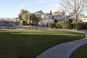
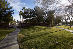
Paseo Verde Drive, Henderson, Nevada: digital photograph
Date
2018-02-03
Archival Collection
Description
A pathway cuts along a neighborhood park inside the Richmond Terrace development Paseo Verde Parkway near Valle Verde Drive in Henderson, Nevada.
Image